This morning I went to one of my favorite hiking areas, Mount Kit Carson. I had originally planned to go hiking with a friend in the Kaniksu National Forest, however, it was cancelled for medical reasons. So at the last minute I decided to go to Mount Kit Carson.
Now that Fall has arrived in the beautiful Pacific Northwest, the weather is cooling down with plenty of rain. It is my favorite time of year to hike, as the air smells fresh and the rain really brings out the colors in nature. The vibrant colors also give a sense of depth.
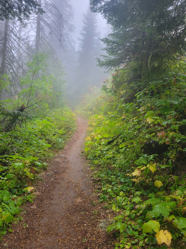
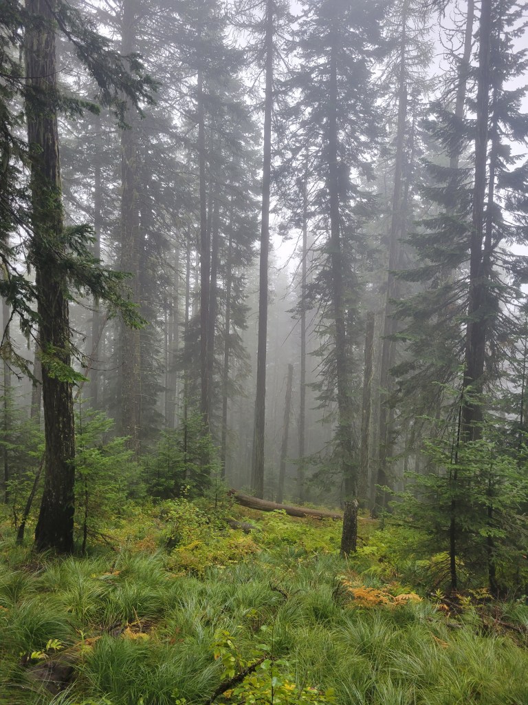
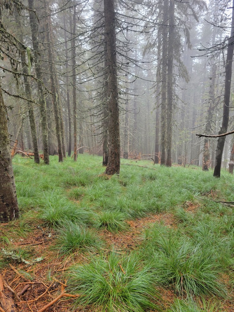
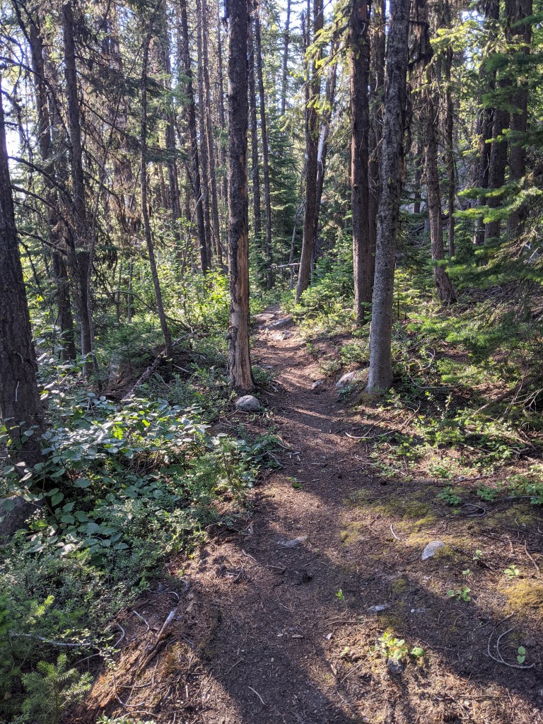
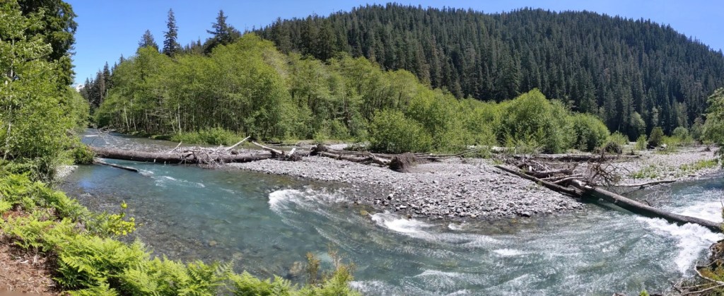
This morning was cold and foggy with quite a bit of rain. The trails were very visible, but not far into the distance. I came across very few chipmunks and squirrels, and was met by a beautiful Doe about a mile and a half into the hike who quietly watched me as I walked by. I went to the trail head without a route in mind; I just knew that I would start hiking on Trail 100 and see which direction my body went as I came across trail intersections. I was not surprised to find myself at the summit of Mount Kit Carson. It is rare for me to hike the area without going to its summit. With it being so cold outside, it was a great time to stop for a hot cup of coffee.
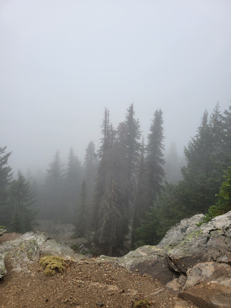
This is the first time I’ve seen the fog at the summit, and it was an amazing experience. It looked so different than any other time I’ve been there and was almost as if I was somewhere else. There is normally a drop-off with many layers of bright blue mountains in the background, but today it was all hidden behind the fog.
This hike was about 7.60 miles and, if you live in eastern Washington, I highly suggest hiking through this area. It has quite a bit to offer during all season of the year!
The Essentials: Day pack Trekking poles (optional, but recommended) Map Compass GPS Knife Water bottle and/or bladder Water filter or purifier First-aid kit Lighter Headlamp Toilet paper or portable bidet
Food: Lunch and an extra day’s supply of food Trail snacks
Additional: ID Cell phone Credit card and/or cash Sunscreen and SPF lip balm Sunglasses Sun hat Hand sanitizer Bug repellent (avoid repellent that has DEET listed as an ingredient, as it can ruin gear)
The Essentials: The 10 essentials Multi-day backpacking pack (recommended 50L or 65L) Tent Sleeping bag Sleeping pad Pillow Trekking poles (optional, but recommended) Knife First-aid kit Headlamp Bear canister (if camping around bears)
Kitchen: Stove and fuel Cooking pot Eating utensil Lighter Water bottle and/or bladder Water filter or purifier
Food: Breakfast, lunch and dinner for the duration of your trip Trail snacks Extra day’s supply of food
Toiletries: Sunscreen and SPF lip balm Hand sanitizer Bug repellent (avoid repellent that has DEET listed as an ingredient, as it can ruin gear) Toothpaste and toothbrush Trowel Toilet paper or portable bidet Anything extra you might need (eyedrops, face wash wipes, etc.)
Clothing: Moisture-wicking top Moisture-wicking pants, leggings, or shorts Moisture-wicking underwear Wool socks Jacket Fleece jacket Rain jacket (if there is any chance of rain) Hiking boots or trail runners Sun hat Sunglasses Camp shoes (optional)
Additional: ID Cell phone Credit card and/or cash Camera Portable charger
Nutrition – At least an extra one-day supply of emergency nonperishable food.
Hydration – Carry extra water and the means to filter or purify more in an emergency.
Emergency Shelter – If not already traveling with a shelter, consider carrying extra protection from a storm, such as an emergency blanket or bivy, or tarp.
I took my very first solo hike! For this hike, I went to the Colville National Forest around Sherman Peak. It was about a 2-hour drive from where I live and was a beautiful drive, especially when crossing the Columbia River and near Franklin D. Roosevelt Lake.
I parked at the Kettle Crest Trailhead, which provided a navigation board with paper maps. I always take advantage of these maps because they tend to show a bit more than other maps, or even what I was able to find on the internet. The paper maps provided at this trailhead are Kettle Crest Trail North #13, Kettle Crest Trail South #13, and Columbia Mountain Trail #24 – Sherman Trail #12 – Kettle Crest Trail #13 to Jungle Hill. The maps also provide elevation information, recommended seasons for hiking the trails, and length.
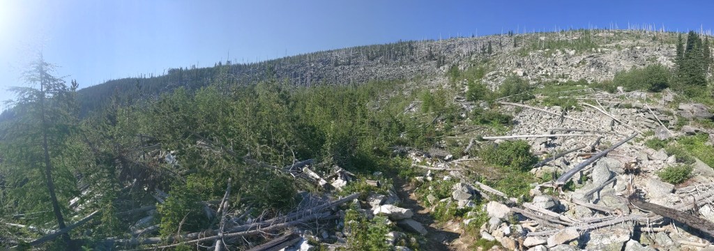
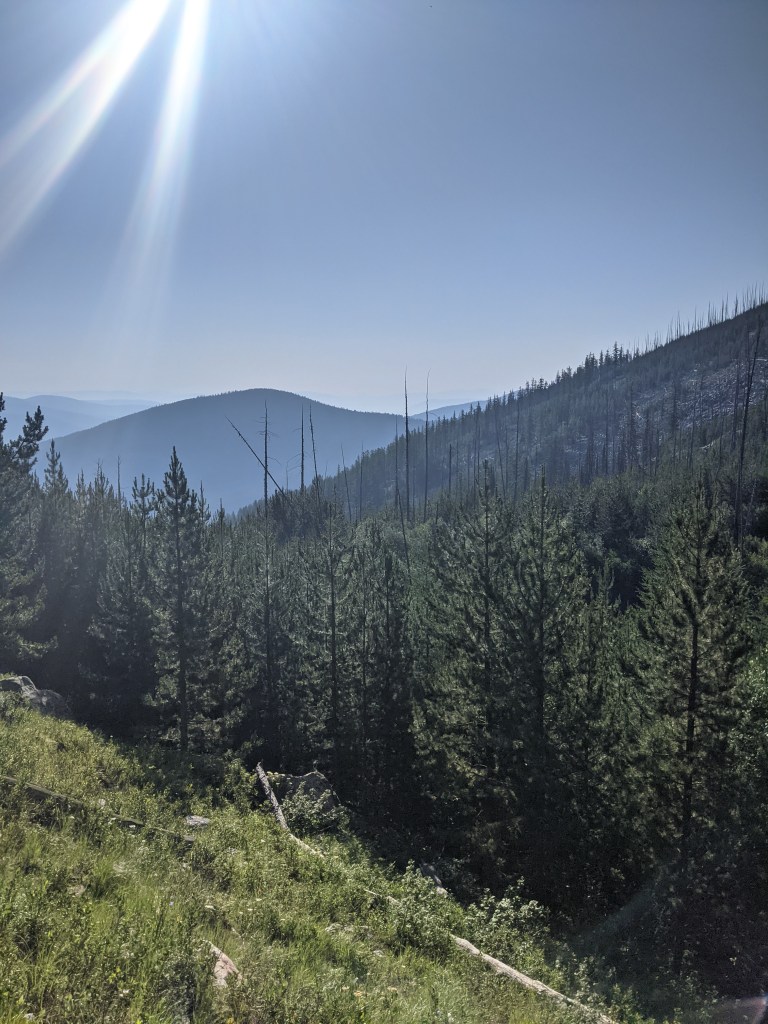
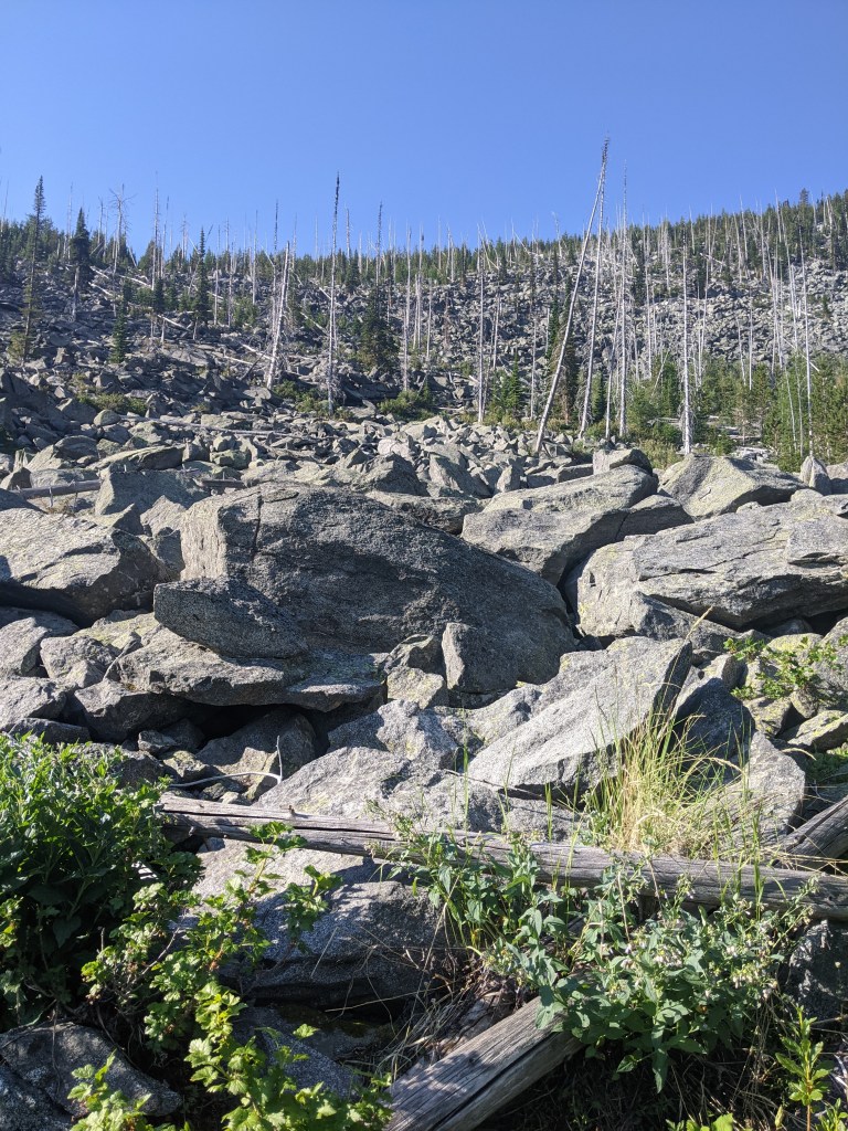
This trail was pretty straightforward. Once you cross the highway and begin your hike, you will come to a ‘Y’ in the trail. I chose to go left which took me up to the White Mountain fire area. The White Mountain Fire Complex, as it was called, engulfed Sherman Peak, Mount Washington, Edds Mountain, Bald Mountain, and White Mountain. It was a lightning caused fire which burned 20,126 acres in 1988. While nature has worked hard to restore itself, you can still see quite a bit of the leftover destruction that was caused.
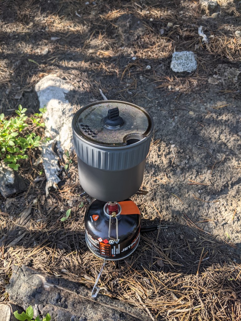
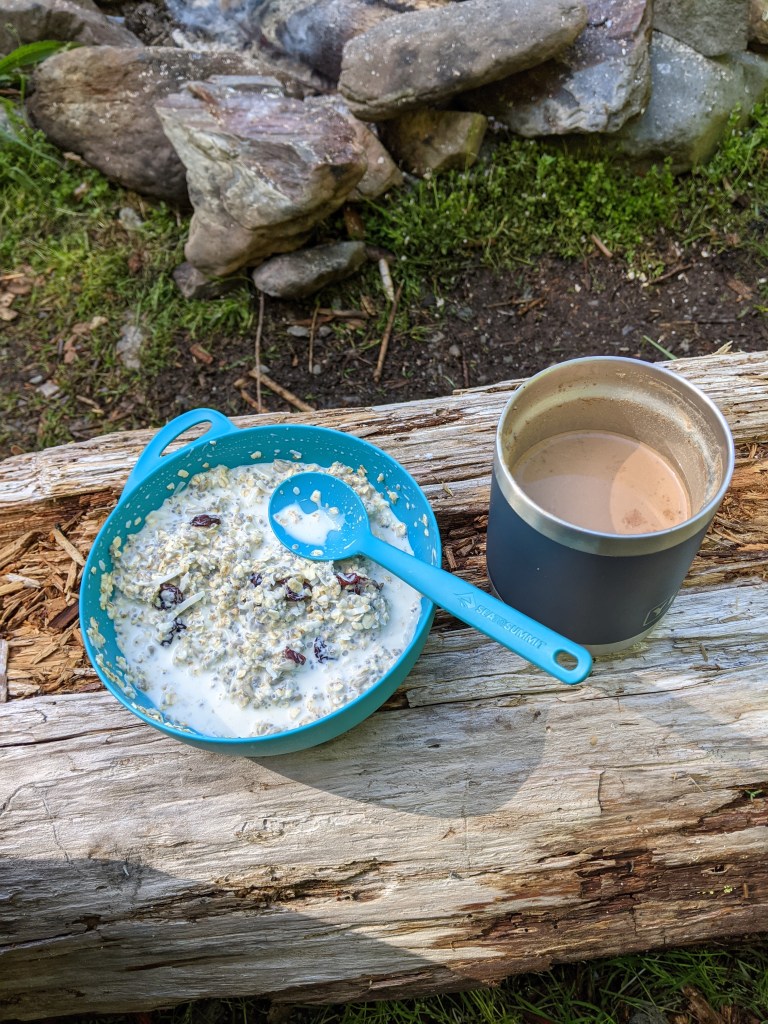
I stopped about 2 miles into the hike for some breakfast which was a simple granola with fruit and a cup of coffee, of course. I recently replaced the Jetboil Flash with the MSR PocketRocket and was excited to try it out. If you’re curious as to how they compare, stay tuned! I will be posting a comparison of the two very soon!
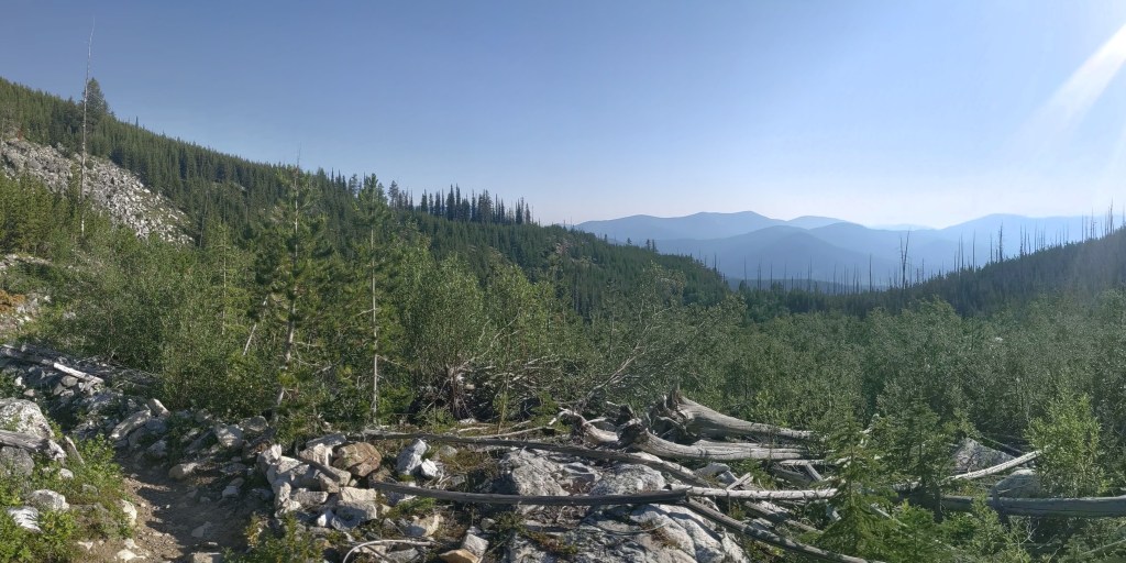
I would highly recommend this trail. It is a short 5 1/2 mile hike and while there is a pretty steep climb in some spots, it didn’t feel overwhelming. The view at the top of the endless mountains makes the drive worth it. Plus, if you’re feeling extra adventurous you can drive the additional 28 miles to the Canadian border!
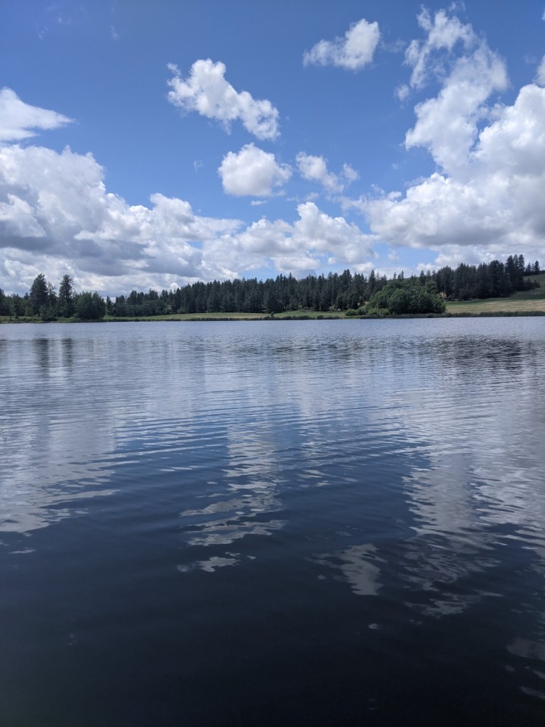
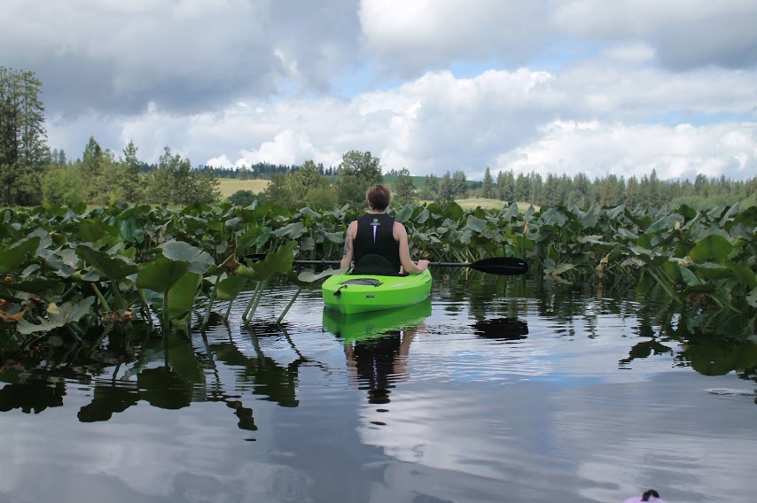
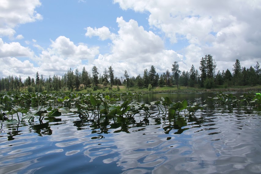
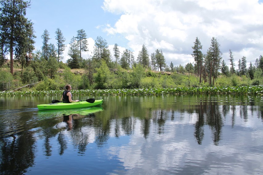
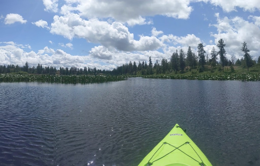
I went to Horseshoe Lake with my friend, Rocki, for a morning of kayaking. It was our first trip of the season and it did not disappoint!
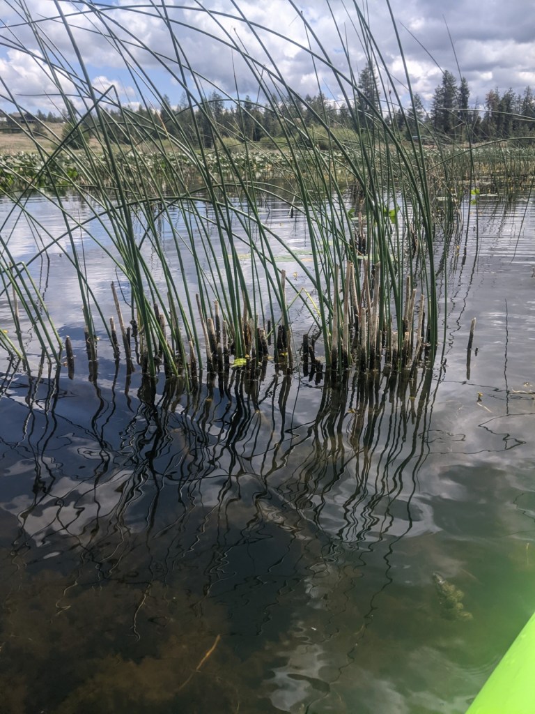
From the moment we launched our kayaks into the water, we were met with a maze of lily pads which was only in the center of the lake. There were clear paths through the lily pads which we explored and eventually found our way out of them and into the south end of the lake.
Photo by Rocki MartinPhoto by Rocki Martin
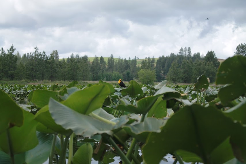
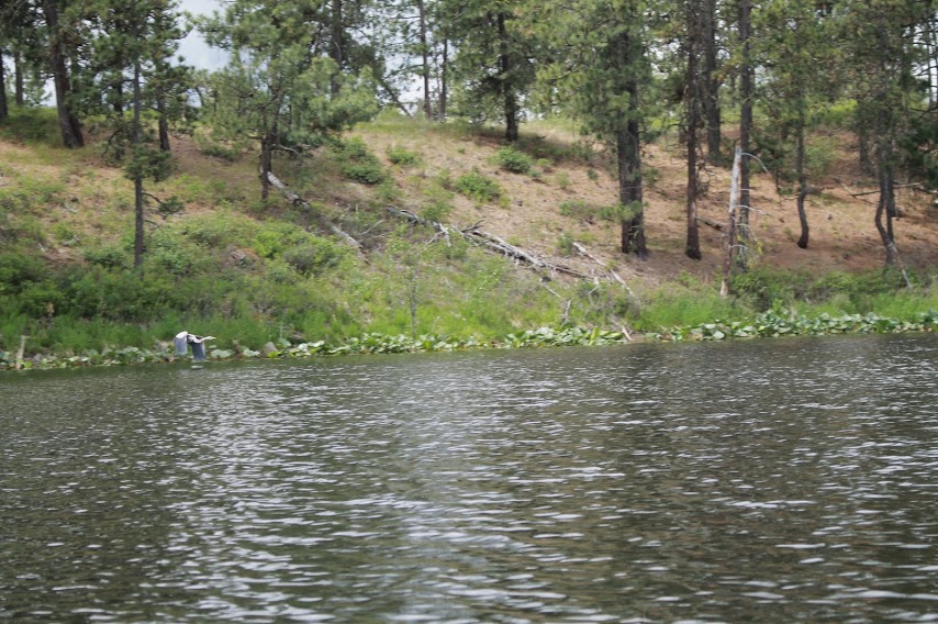
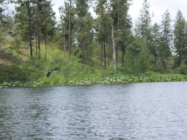
We saw many Blue Herron, Yellow-Headed Blackbirds, ducks, turtles, and a Bald Eagle. We were able to see one Blue Herron swoop down to the lake and catch a fish.
Yellow-Headed Blackbird Photo by Rocki Martin
Yellow-Headed Blackbird Photo by Rocki Martin
Blue Herron Photo by Rocki Martin
Blue Herron Photo by Rocki Martin
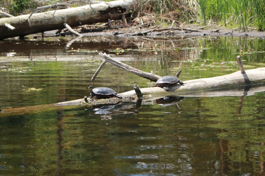
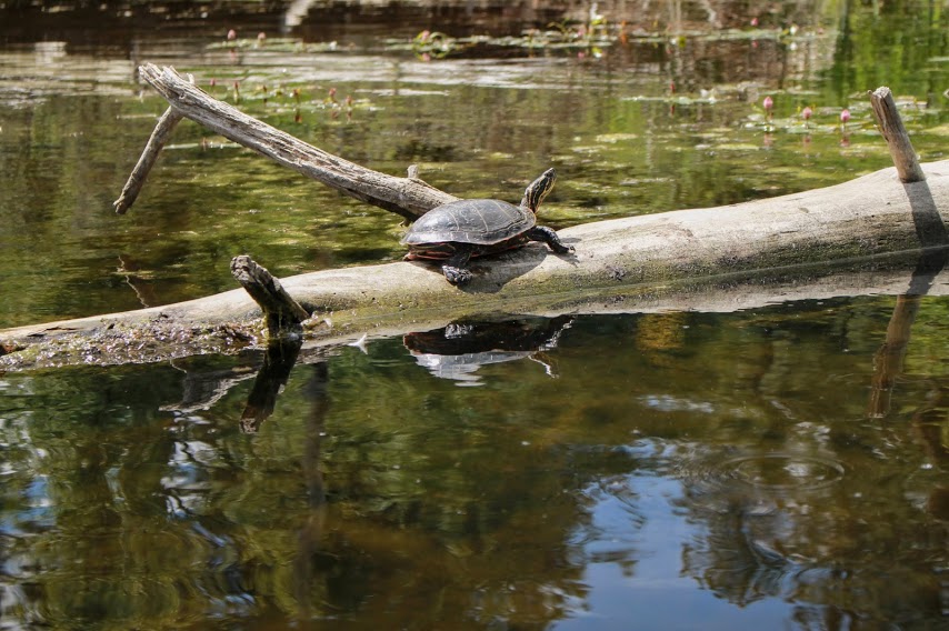
We ventured back through the lily pads to get to the north end of the lake which then, as the name says, horseshoes around the peninsula where we saw many turtles sun bathing on thick branch protruding from the water.
Turtles Photo by Rocki Martin
Turtles Photo by Rocki Martin
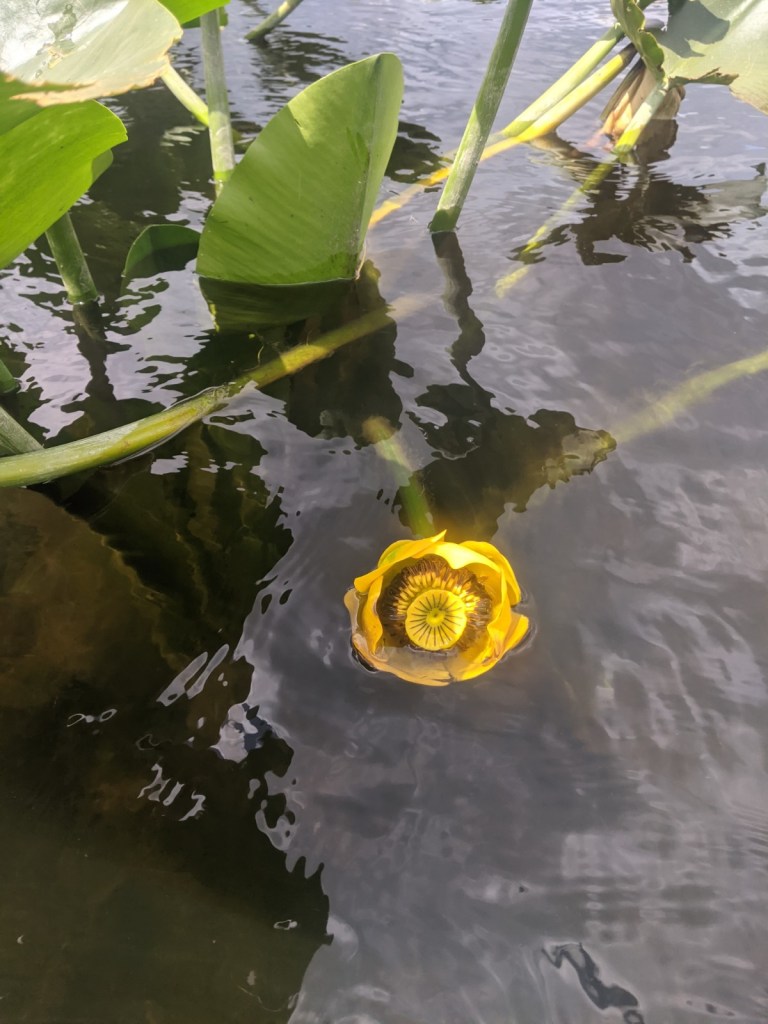
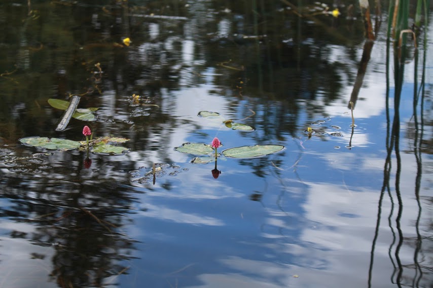
We also saw many beautiful Yellow Water-lilies around the lily pads and small pink flowers floating in the shallow areas of the lake. I am not sure what type of flower the pink ones are.
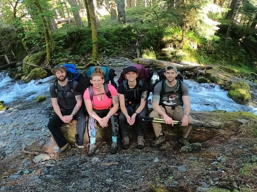
Wow, what a trip this was! I went on a 4 day backpacking trip through the Olympic National Forest, a total of 32 miles with my brother, cousin, and cousin’s husband; Josh, Paullena, and Kyle. We hiked along the Quinault River on East Fork Quinault River trail.
Paullena, and I started planning this trip in November 2020 but, at that time, the permits were not available. Our goal was to hike into Enchanted Valley after seeing pictures and videos of how beautiful it is, but did not expect to be able to stay the night there as permits can be difficult to come across with the number of permits being issued is very limited. As we were talking on the phone, they became available which meant we ordered them right away! Then, after nearly 7 months of waiting the day was finally here. We had a 7 1/2 hour drive to the trailhead from where we live in eastern Washington, so we all stayed the night leading up to it at Paullena and Kyle’s house.
Day 1
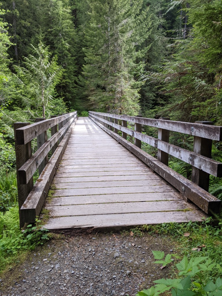
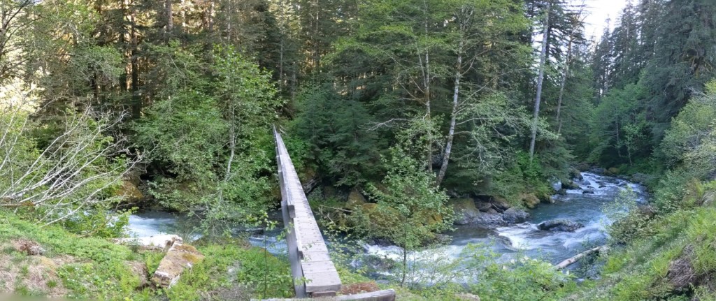
We arrived at the Graves Creek trailhead around 3:00 PM and eagerly got out of the car to start loading our packs. We had about an 8 1/2 mile hike to our first night’s camping spot, the O’Neeil Creek campsite.
The trailhead bridge
Because we had a late start to the day (sick child which many of you can relate), we knew we had to hike at a fairly decent pace to avoid having to hike after sundown. There was so much to see which slowed us down, but we wanted to take in as much of the experience as possible. There was so much to see and we stopped every few minutes to look around and take a picture.
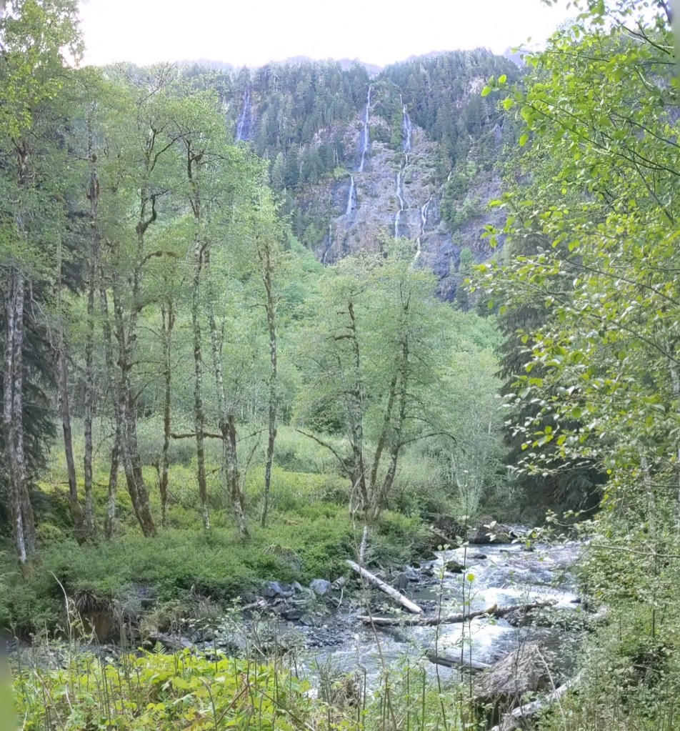
The first campsite we came to was at Pony Bridge, about 2 1/2 miles from the trailhead. There was another long bridge crossing the river with a small waterfall coming from the creek above the river. This bridge was followed by a trail that went through the creek. It was fairly difficult to hike this area because of the rocky terrain, but it was fascinating and beautiful.
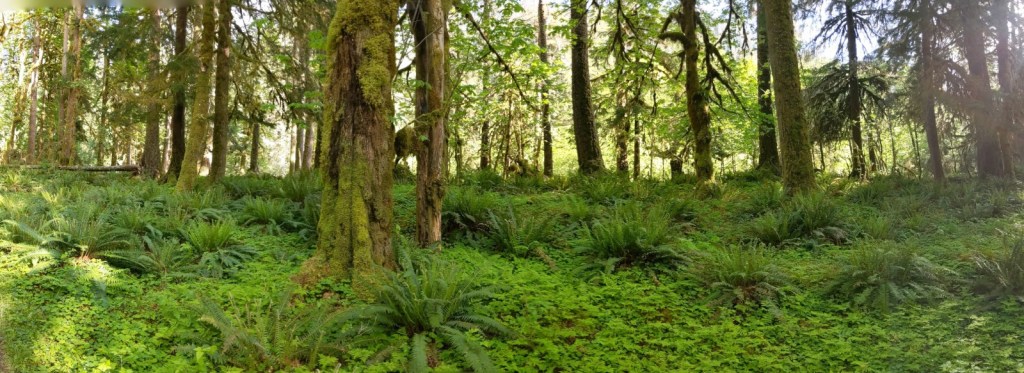
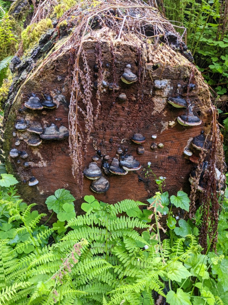
The trees were covered in bright green with mushroom shelves wrapped around the trunks. Many of the trees were enormous in size with what looked to be dens at the base, most likely a popular spot for black bears to sleep. There were also many meadow-like areas filled with ferns, clovers, and small flowers.
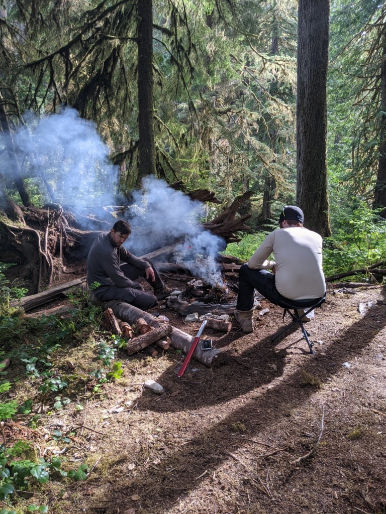
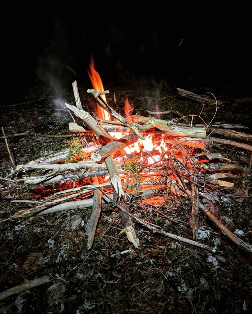
We made it to the O’Neil Creek campsite around 7:30 PM and immediately began setting up our camp. Josh was the first person to set up his sleeping area and began collecting wood for our fire while Paullena, Kyle, and myself finished setting up our sleep area. I had to get a bit creative as we were in an area with many small trees that would not support my hammock, and I did not want to risk breaking any trees. Once we were settled into our campsite for the night, we enjoyed a short campfire before deciding to go to sleep.
Day 2
I woke up around 8:30 to the sound of Josh collection firewood for our morning campfire. Wait, did I just say 8:30? That never happens with having two young children. We took our time that morning with cooking breakfast and packing up our camp, and didn’t start the day’s hike until around noon. We had an almost 7 mile hike into Enchanted Valley and wanted to leave ourselves with plenty of time to enjoy it.
My breakfast was Bivy Bran Flakes and a mocha, all made at home. If you have been following my blog since the beginning, you will already know that most of my trail food is homemade.
There were many creeks to cross on this day; some creeks were shallow which allowed us to just walk through them, while other creeks were deep and we had to use logs and large rocks to cross. Some creeks also had beautiful bridges that almost looked handmade.
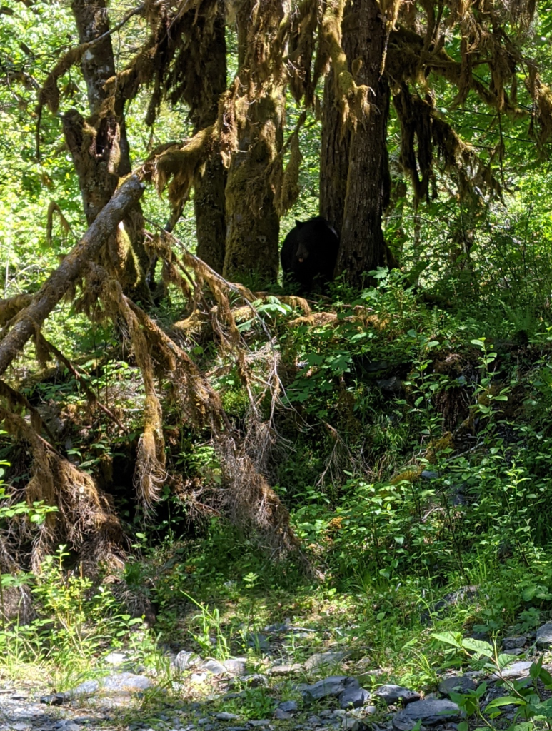
We decided to stop about halfway between the O’Neil Creek and Enchanted Valley, at Pyrites Creek. We had been told by another hiker earlier in the day to watch for black bears, that there had been three sightings already that morning.
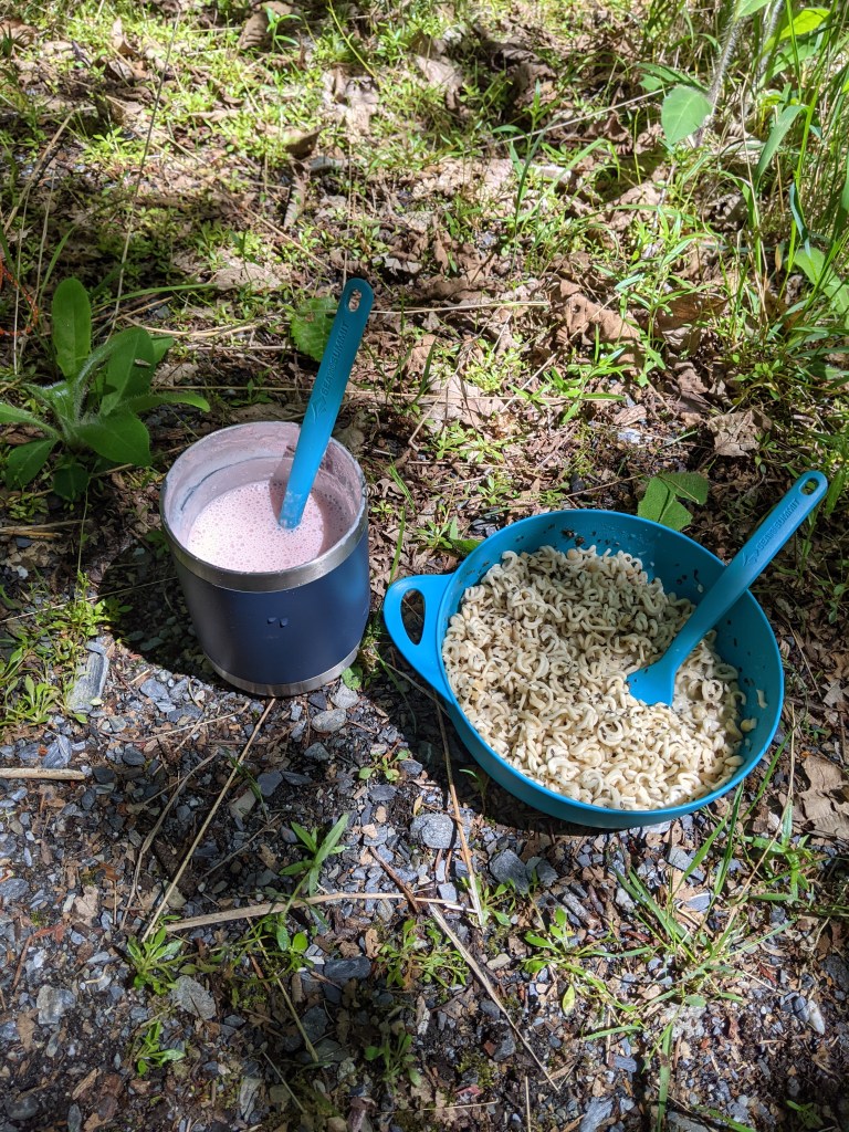
We eventually made it to Pyrites Creek and found a small area along the water which we thought was perfect for eating lunch. We unloaded our packs and began preparing our food when we looked over to see a black bear watching us. It was about 25 ft away. It startled me a bit because I was not expecting to actually see a bear let alone being so close to one. While it seemed pretty docile, we quickly packed our lunch back into our packs and hiked about a half mile before finding another spot to eat lunch, just on the other side of a bridge that crossed over the river. It also had a small area where we could collect water to fill our water reservoirs.
My lunch was Parmesan Pesto Ramen, dried mango slices and a Chai Latte.
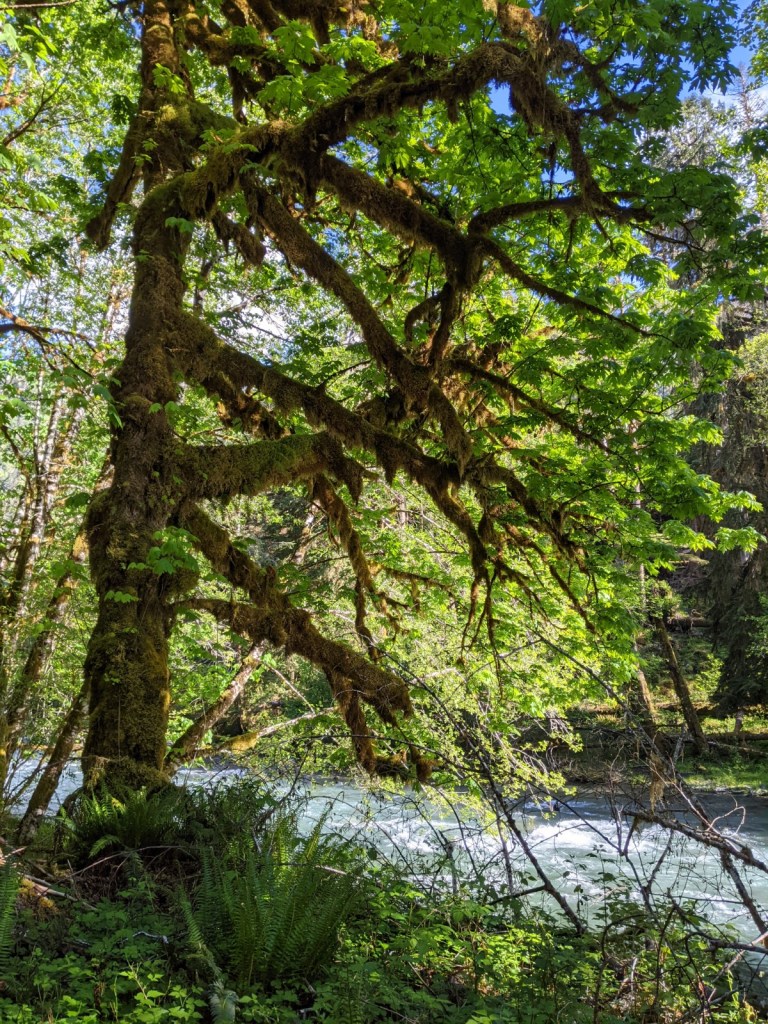
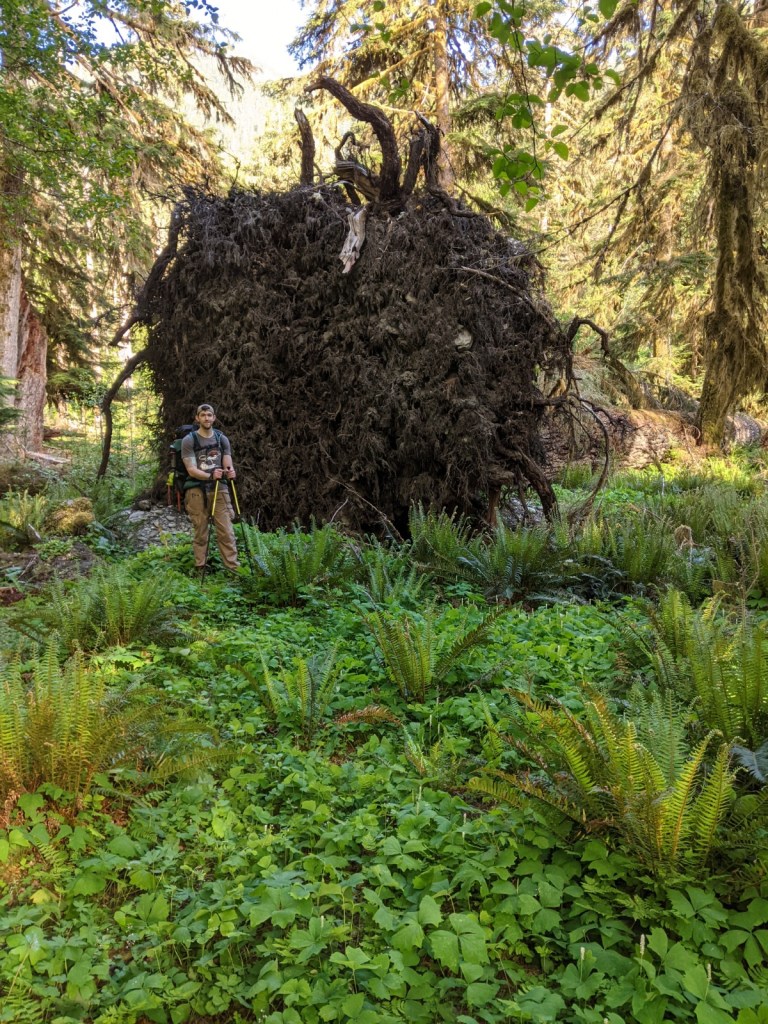
We eventually started hiking again and were still fascinated and amazed by what we saw. I cannot say enough how beautiful this forest is and pictures are not enough. We also saw trees that were covered in moss at the base with bright, bushy leaves above as well as quite a few “Tarzan trees” between Pyrites Creek and Enchanted Valley; the branches were long and tangled, covered in moss and seemed to have no beginning or end. We also came across quite a few fallen trees with root systems like you wouldn’t believe! We had to take a few pictures for size comparison, of course, because we do not have anything like it at home. Many of the fallen trees had new trees growing from them. The trail continued to offer stunning views of the river as well. The water was flowing quickly and was so peaceful.
We got the entrance of Enchanted Valley around 5:30 PM and had to cross a very long and narrow bridge across the river. If you have a fear of heights, it would be a difficult bridge. It was just wide enough for your feet and any loss of balance would be trouble.
Once we crossed the bridge we hiked just a few minutes more before having to cross a small section of the river, then went alongside a very large meadow. Paullena and I were so excited to be in the heart of enchanted Valley so when it finally came into sight, we stopped and just stared at it. It was breathtakingly beautiful!
Located in the center of it is the Enchanted Valley Chalet. It looked extremely old and was close to the river bank so I wanted to research it a bit once I was back home.
Here is a brief history of the chalet:
– It was built during the summers of 1930 and 1931, and opened on August 6, 1931.
– The Olympic Recreation Company retained a special use permit and operated the Enchanted Valley Chalet as a backcountry resort for eleven years (1931-1942).
– Olympic National Park was established in 1938. It included all of Mount Olympus National Monument and Enchanted Valley.
– During World War II the Aircraft Warning Service stationed two plane spotters at the Chalet for roughly a year and a half (1943-1944).
– The building was sold to the National Park Service in 1951.
– Olympic National Park staff reopened the Enchanted Valley Chalet for the public to use as a shelter in 1953. It served as a shelter for sixty years (1953-2013).
– The Enchanted Valley Chalet became a Backcountry Ranger Station when the first seasonal ranger was assigned to it in 1954. It served as a Ranger Station for fifty-nine years (1954-2013).
– The Enchanted Valley Chalet became undercut by the East Fork Quinault River and was closed in spring of 2014.
– Enchanted Valley is home to the world’s largest Spruce Tree, which currently stands 191 feet tall and is about 1,000 years old. It is about 3 miles from the camping area (we did not hike to it this time around).
Enchanted Valley Chalet and Anderson Peak
Enchanted Valley Chalet from the Quinault Riverbed
Anderson Peak
Once we set up our camp, Josh and I wandered around Enchanted Valley. There were quite a few waterfalls and the river was so low in this area that we were able to walk into the riverbed.
A few of the waterfalls from the entrance to Enchanted Valley
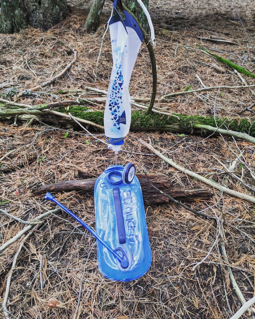
Our camp was right along a small creek which made it quick and easy to get water for our meals, washbag, and drinking. I use the Katadyn gravity BeFree Water Filtration System (3 liters) and it works great! I previously used the Katadyn BeFree Water Filtration System that has a drink nozzle similar to a Smartwater bottle, however, I prefer the gravity filter style. I can easily use it as a washing station and fresh water station at the camp, and I can hang it rather than having to manually having to squeeze the reservoir.
We were also lucky enough to find quite a bit of dry moss for our fire that evening. The forest was humid which meant all of the wood we gathered throughout our trip was damp. I packed cotton balls coated in Vaseline which also helped to actually start our fires.
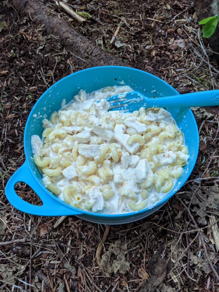
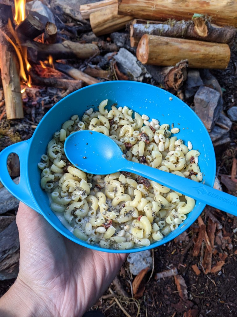
My dinner was Spicy Mac & Cheese with chicken. This was one of my favorite meals all weekend!
Day 3
We set our alarms for 6:00 AM because we had a long hike planned for this day. We were going to hike almost 14 miles from Enchanted Valley to Pony Bridge, the very first campsite we passed once we entered the trailhead. We ate breakfast then packed up our camp.
My breakfast was Bivy Bran Flakes and a mocha.
We started our hike around 8:00 and it was a little tough to leave Enchanted Valley so soon! I would like to plan another trip there with one extra day being spent in Enchanted Valley. There is so much to see!
Our plan was to hike for one hour then stop for a 15 minute break, to keep ourselves moving while still allowing our bodies to rest, eat a snack and make sure our water reservoirs are filled. We made a plan to stop at O’Neil Creek since it was about halfway between Enchanted Valley and Pont Bridge.
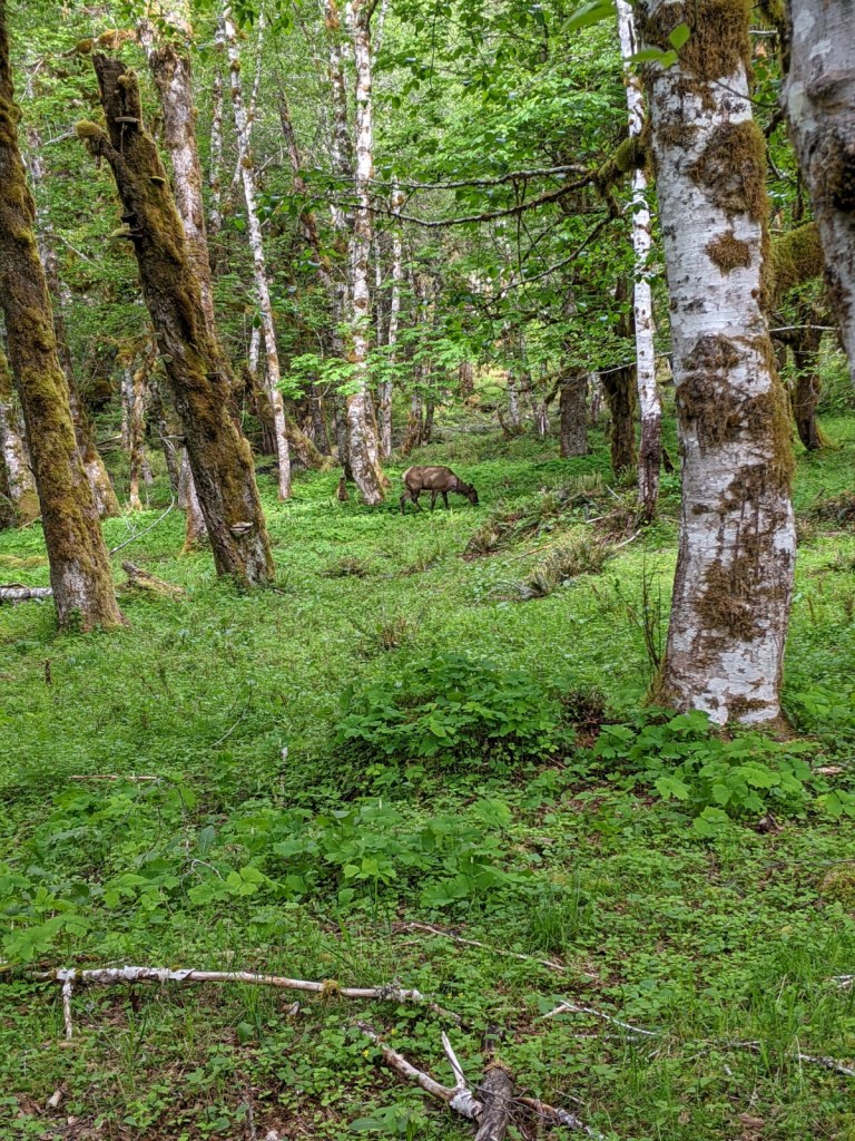
Here is a picture of an Elk we saw in ne of the meadows:
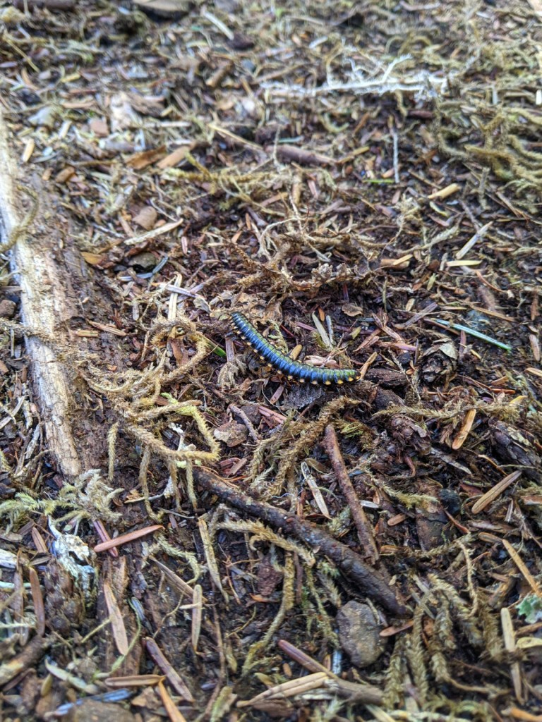
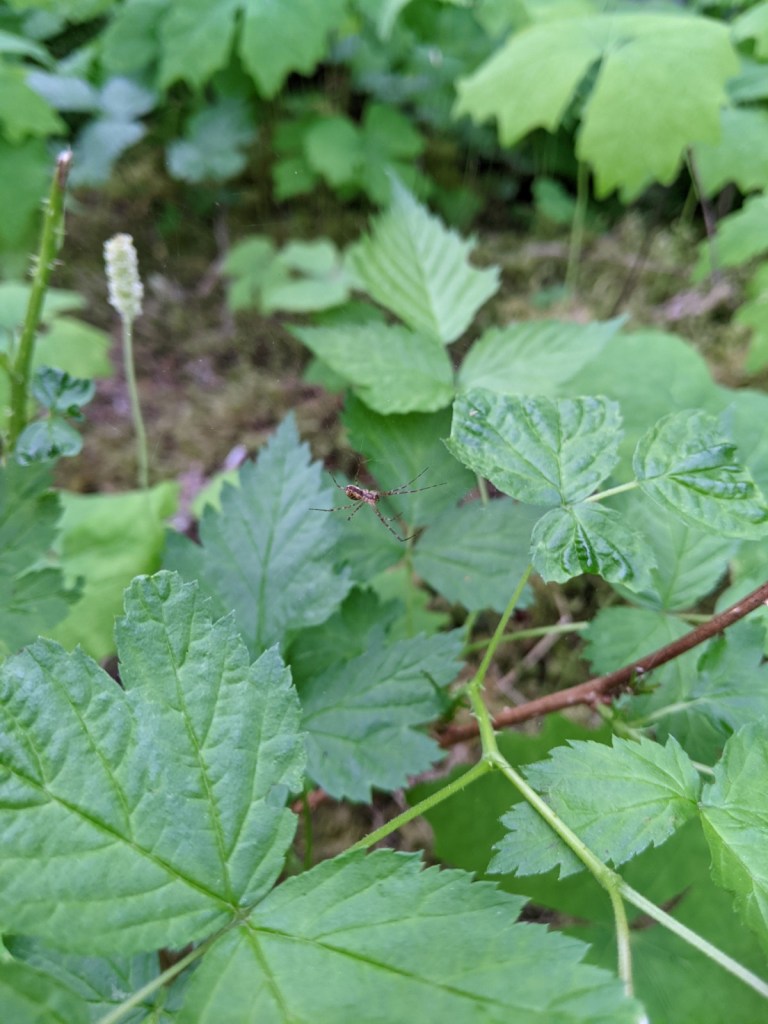
And a few other little critters, of course.
Centipede
A spider that joined me during a snack break
We made it to Pony Bridge around 4:00 which gave us plenty of time to set up our camp, eat dinner, and just relax and have fun together the rest of the night.
My dinner was Sun-Dried Tomato Pesto Pasta followed by Herb and Cheese Spread with Triscuits and Brownie Batter Hummus, which was shared among the four of us for dessert.
Day 4
Just as the day before, we set our alarms for 6:00 AM so we could pack our camp, eat breakfast, and start the day’s hike around 8:00 AM, and allow for the 7 1/2 hour drive back home. We were only about 2 1/2 miles from the trailhead.
My breakfast was Berry Breakfast Crumble.
We met a few hikers along this stretch of the trail and were happy to offer what we knew of the trail from the first three days.
We made it back to the trailhead around 9:30 and it was such an incredible, but weird feeling. This was one tough trail and it felt great to have completed it!
From the left: Kyle, Paullena, Myself, and Josh
Here is a complete list of the meals I ate along the trail (though not all are pictured):
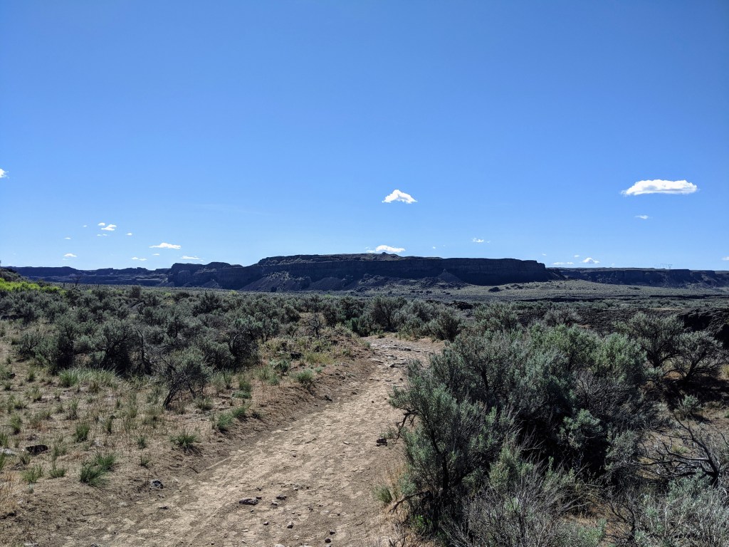
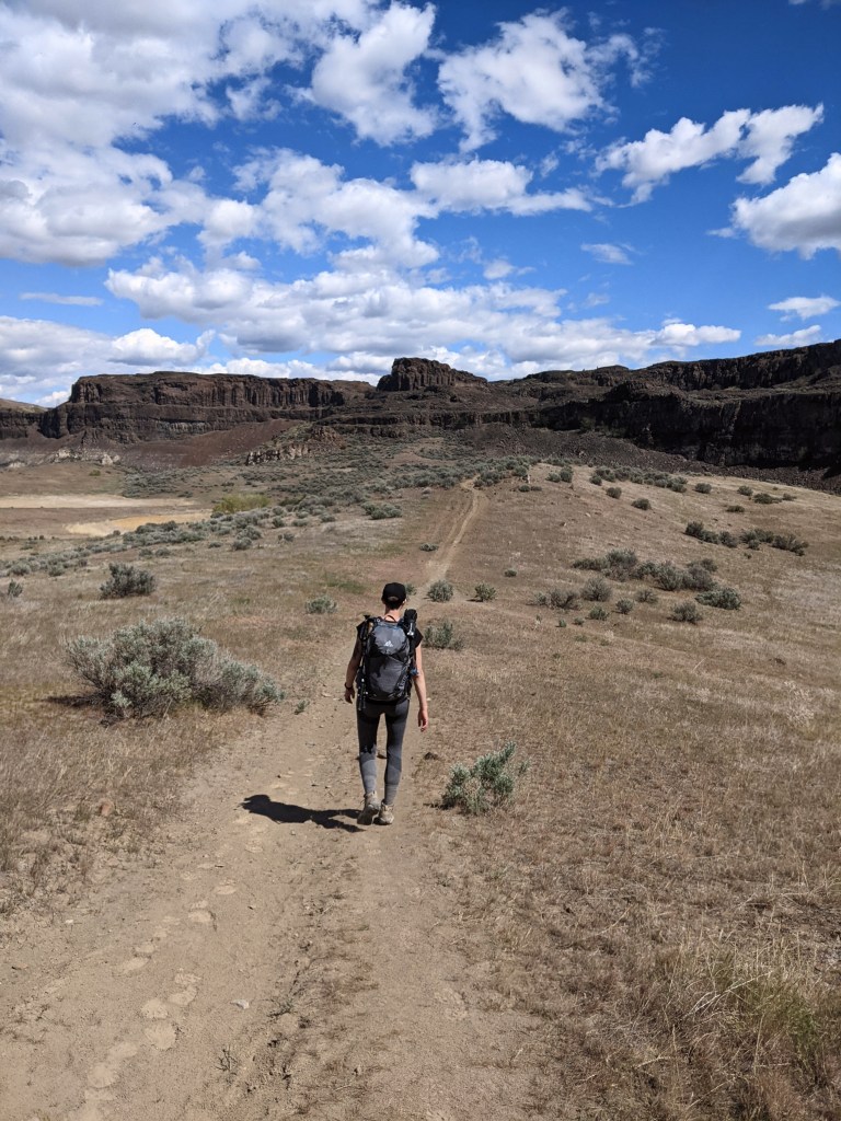
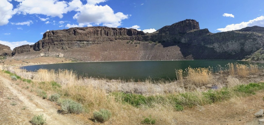
For this hike, I went to Dusty Lake and Ancient Lake near Quincy, WA with my cousin, Paullena. It was about a 2 1/2 hour drive from where we live. It was a nice drive, though a little smelly as we drove through Moses Lake, WA. Quincy, WA is a beautiful little farm town. We drove between many orchards with the farmers busily working in their fields.
To get to this trailhead (from eastern Washington), drive west on I-90 for about an hour. Take exit 151 toward WA-281 N/Quincy/Wenatchee then turn right onto WA-281 N and follow the road for 2.9 miles. Turn left onto Rd 5 NW/White Trail Rd and follow the road for 7.8 miles, then turn left onto Rd 9 NW. Follow this road for 5.8 miles until you come to the trailhead parking lot.
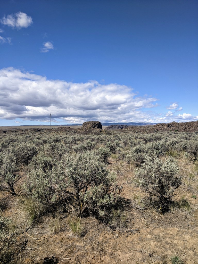
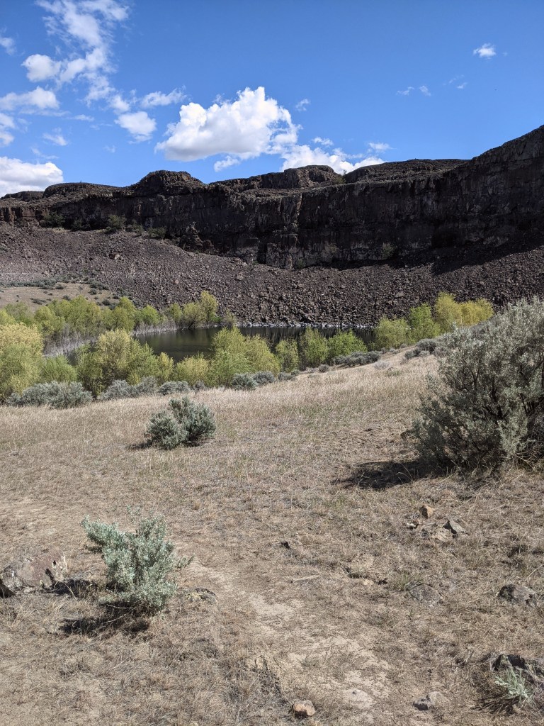
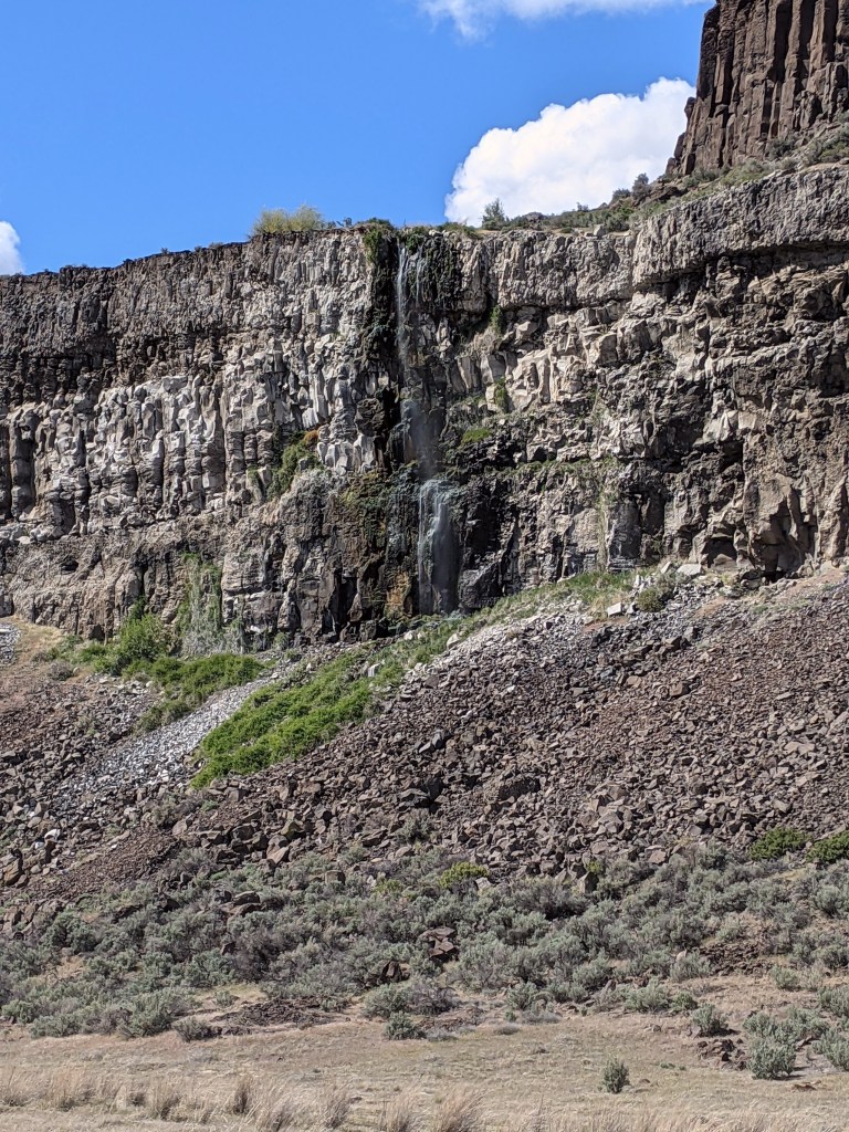
Upon entering the trail we were immediately surprised with a beautiful view. It was a desert-like area with fascinating bushes and beautiful basalt cliffs. I had never hiked anywhere like this before! It was a clear hot day with bright blue skies and puffy white clouds. It reminded me of a painting with how imperfect the clouds were.
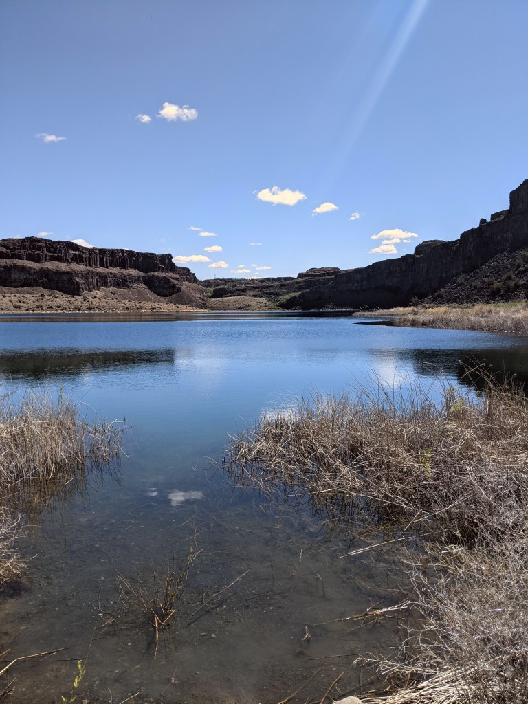
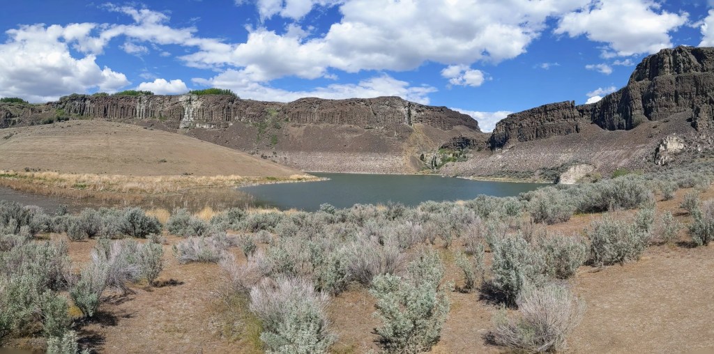
We had been hiking about 3 1/2 miles we hiked up a small hill when we were given the beautiful view of Dusty Lake. It was tucked into the far end of the valley (which I learned is also called a “coulee”) and it would be easy to miss if you didn’t know to look for it. With there not being much elevation gain on this trail, you are not able to see the lake until you are actually at it’s edge.
Dusty Lake
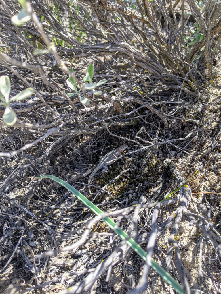
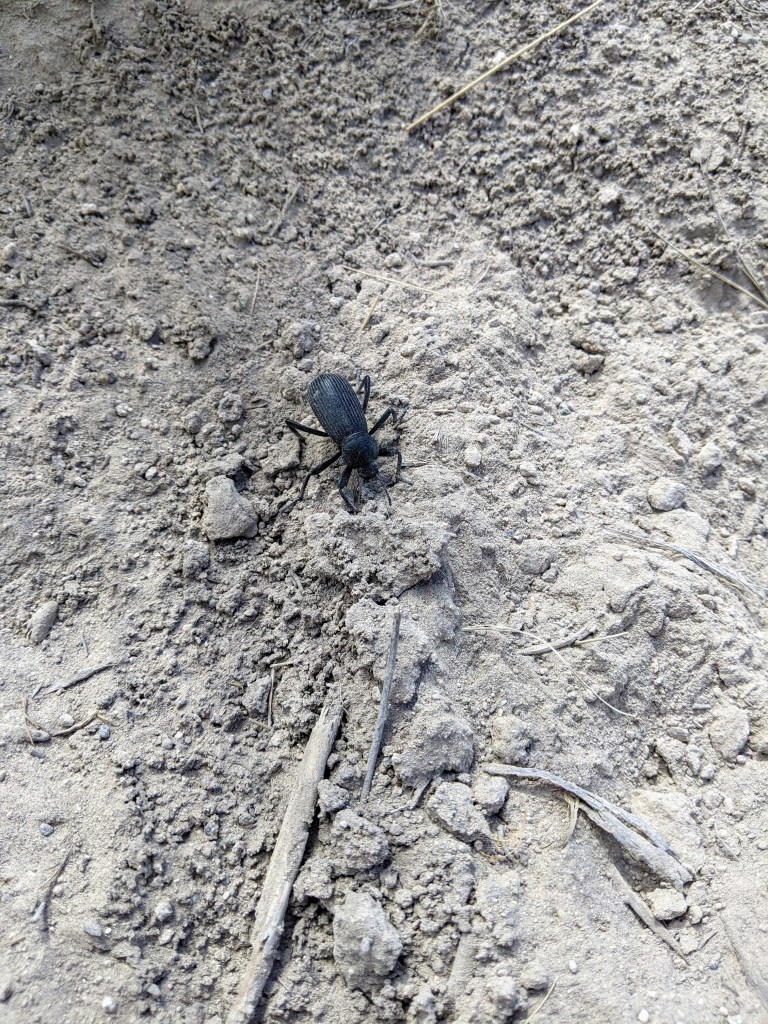
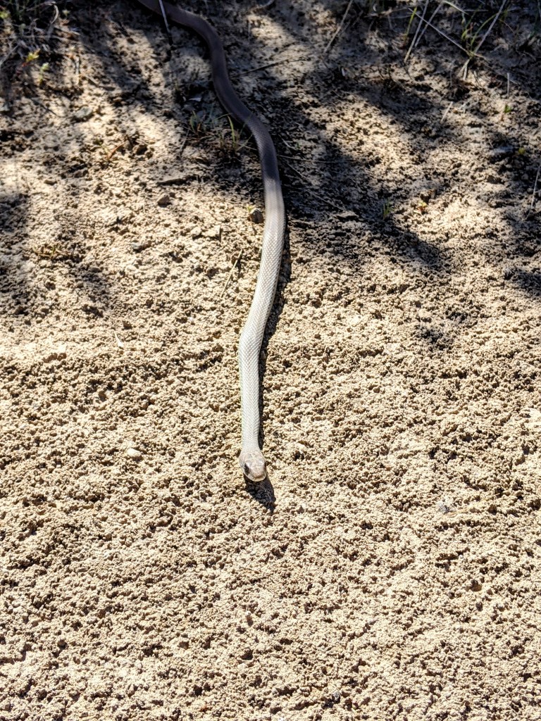
We wanted to enjoy this beautiful lake for a bit longer and decided to stop for lunch. I decided on tortilla soup (recipe is on the Trail Recipes page) while Paullena decided on teriyaki chicken and rice. We were greeted by a small lizard and a few ducks who were splashing around near the edge of the water, most like looking for lunch themselves. The lizard ran for the bush as it saw my shadow then stopped long enough for me to take a picture. I also found a cute little snake on the way to Dusty Lake that was soaking in a moment of warmth on the trail and not bothered by our presence, as well a large beetle that, at first, looked like a large spider. I believe the snake is a Western Racer.
We sat for about 45 minutes before deciding to continue our hike. It was rather difficult to pack up as it was a quiet, peaceful area that one could sit in all day, soaking in every sound, sight, and smell. The birds chirped as if they were laughing and while we did not see any waterfalls, we could hear the water flowing nearby. There were two large rocks poking through the water’s surface that reminded me of a partially sunken ship.
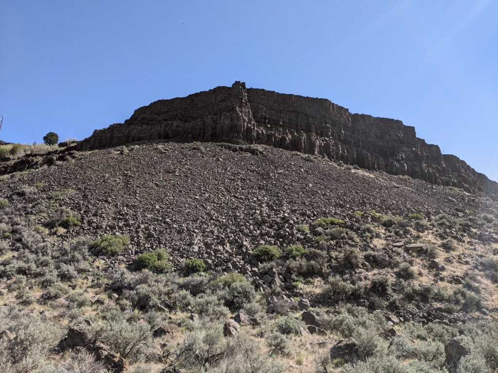
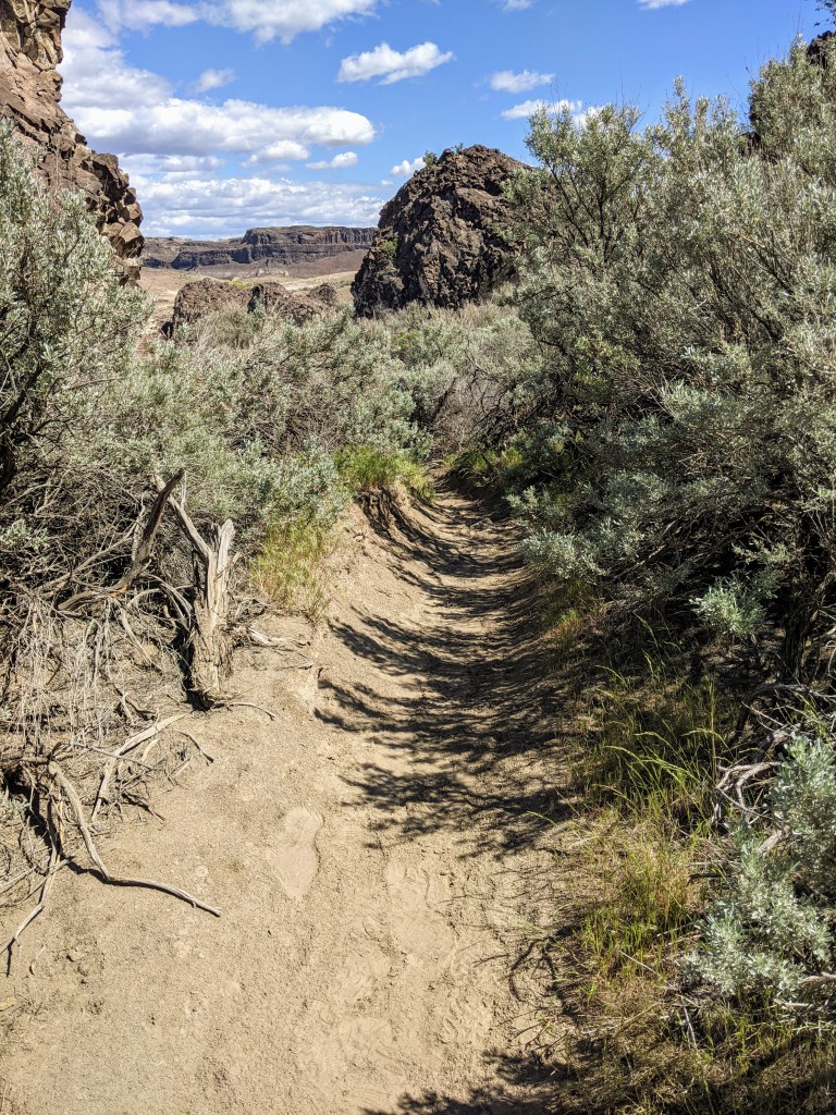
We hiked another 2 to 2 1/2 miles out of that area of the valley and into the next, this one having a bit more of an elevation gain. We hiked through tall bushes and large rocks, some having circular shapes while others were very square.
Just out of the rocks and making the last small trek to Ancient Lake.
While we were unknowingly getting close to Ancient Lake, we were still unable to see it even though it was just on the other side of the rocks. Ancient Lake is made up of three very small lakes with a ring of bright green trees around the smaller lake, and one larger lake about the size of Dusty Lake. This area is a bit more popular, as we noticed a few small tents; a bright blue tent on the ridge above the lake, and orange tent along one of the small lakes, and a grey tent on a hill above the lake.
Ancient LakeAncient Lake
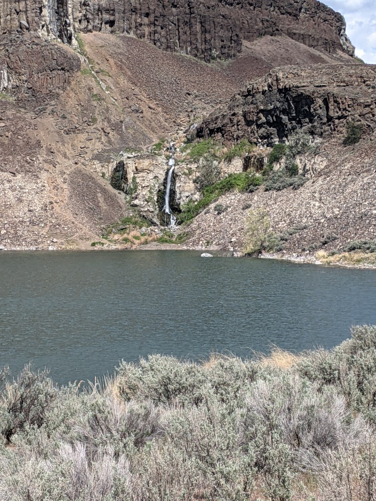
We decided to stop for a snack; I went for s’more trail mix while Paullena went for a cherry Pop-Tart. A sweet treat is exactly what we needed although the chocolate chips in my trail mix were partially melted (but still enjoyable). We sat for about 15 minutes, watching the waterfall and watching someone climb around the top of it with their canine friend.
After our snack break we decided to start heading back towards the trailhead, as it was getting late in the day and we wanted to get home in time to tuck our children into bed.
We came across two more waterfalls in the side of the cliff which spiked my curiosity. I wondered where the water went when there isn’t a body of water at the bottom of it; maybe there was a small cave or pool, or maybe it just soaked into the ground. I started climbing up the rocks and about halfway up, realized it was an extremely unsafe climb with the height and looks rocks, so I turned myself back. A part of me really wanted to climb all the way up to the bottom of the waterfall but a part of me didn’t want to take the risk.
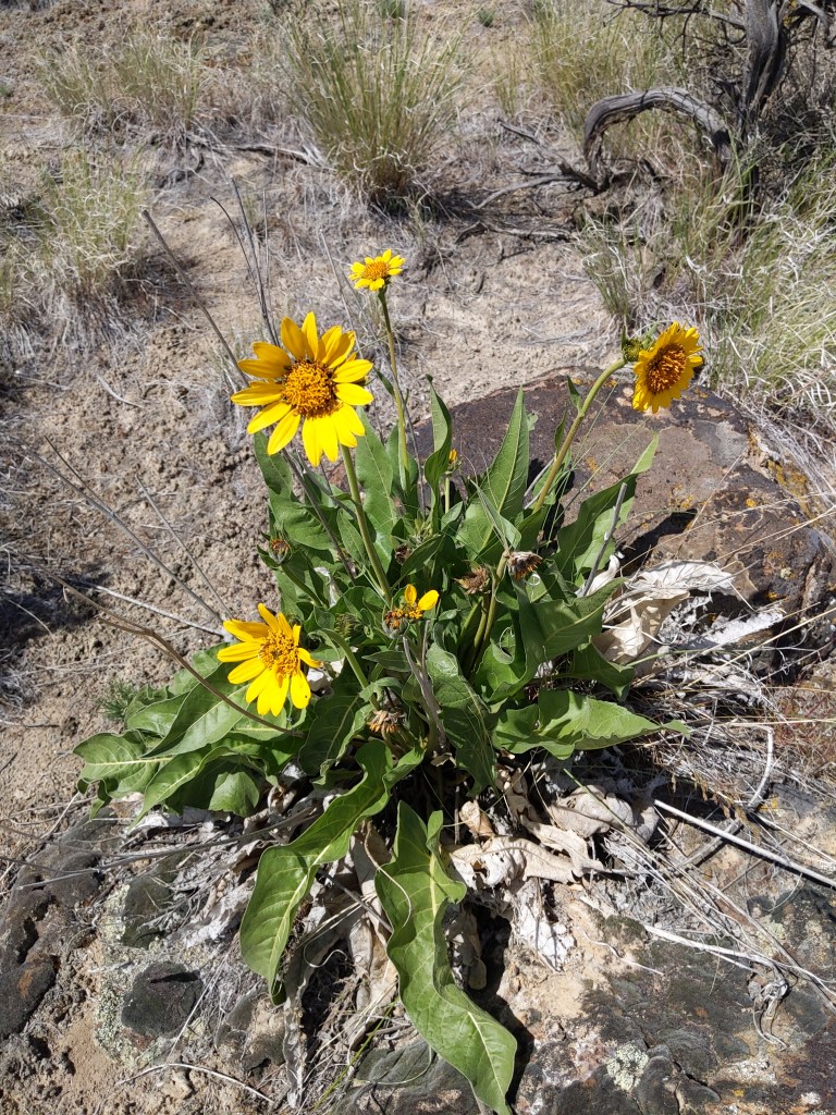
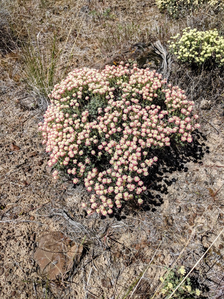
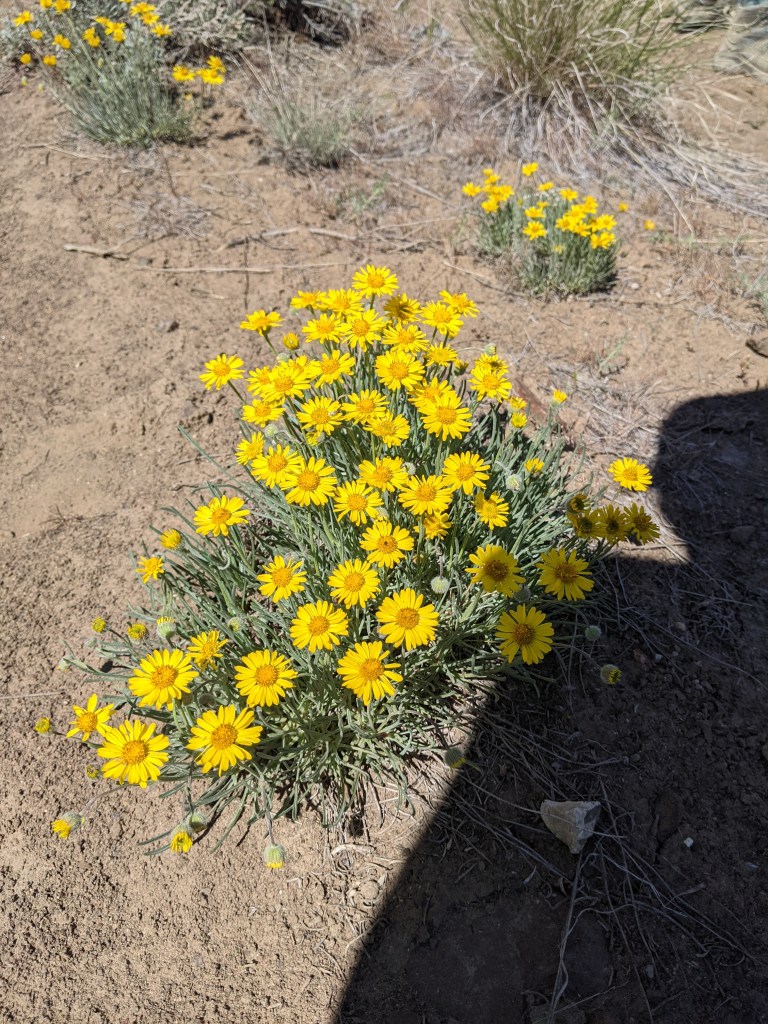
As we continued down the trail we noticed quite a few flowers in the area. Some were a bright yellow or purple while others were a pale red. They smelled fantastic! It reminded us of the poppy field from The Wizard of Oz with how many flowers would be in just one area.
I also came across this rock that, to me, looked like a toad. You might not see it but it’s a cool rock either way.
The view on the way out of the valley was breathtaking. It was basalt rocks on either side of us with a field of thick bushes and mountains straight ahead. It was our last view of the trail before getting to the trailhead and definitely one to remember.
While it was a very hot day, it would be an enjoyable location for camping. Paullena and I talked about how we would very much like to go back there this summer to camp, and which area we would stay in.
I would highly recommend this trail. It is just shy of 9 miles with a minimal elevation gain of about 570 feet.
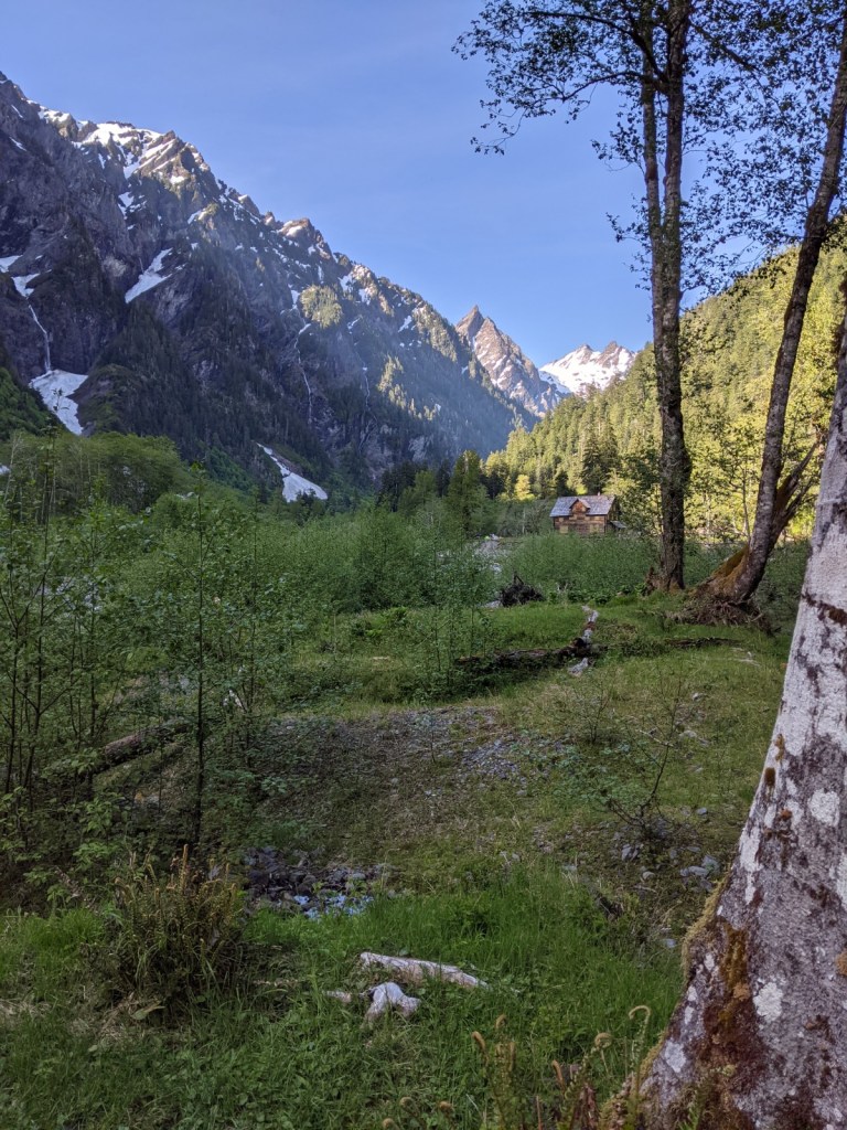
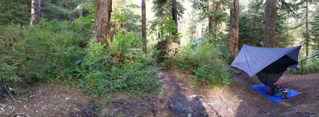
I went on an overnight trip with my cousin, Paullena, to Mount Spokane and Mount Kit Carson. It was a fantastic little weekend getaway that was close to home.
My main goal was to make sure everything was right with my new sleep system. I decided to go the hammock route.
My sleep system consists of the following:
Wise Owl Outfitters double hammock
Wise Owl Outfitters hammock underquilt
Wise Owl Outfitters rain fly tarp
Kelty Ranger Doug 30 sleeping bag
Wise Owl Outfitters camping pillow
I also have a single-person hammock, however, the double hammock is longer in length and, with the extra fabric was able to fold it completely over myself to create a warm cocoon.
Once we had our camp set up, we ate lunch then headed to the trailhead for Mount Kit Carson around 2:00 PM. I opted for a bowl of hot chili and cup of coffee.
This area is one of my favorite hiking spots that is near home. There are many trail options that all come together at Saddle Junction, as well as the option to hike up to just one or multiple summits; Mount Spokane, Mount Kit Carson, Day Mountain, Bald Knob, and Beauty Mountain. I have a few great memories of getting lost on one of my very first hiking trips, falling waist deep into snow, and meeting a mother black bear and her cub which, very abruptly ended our hike as there was nowhere else to go but back down the trail.
To get to the summit of Mount Kit Carson, park at the hairpin parking lot, just past the Rangers Station on N Mt Spokane Park Dr. The trailhead is just across the road once you park. Once you enter the trailhead, take an immediate right at the ‘Y’ onto Trail 103 followed by an immediate left at another ‘Y’, onto Trail 100.
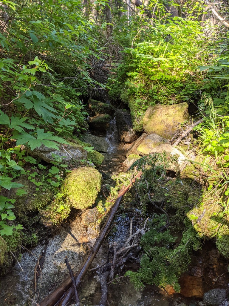
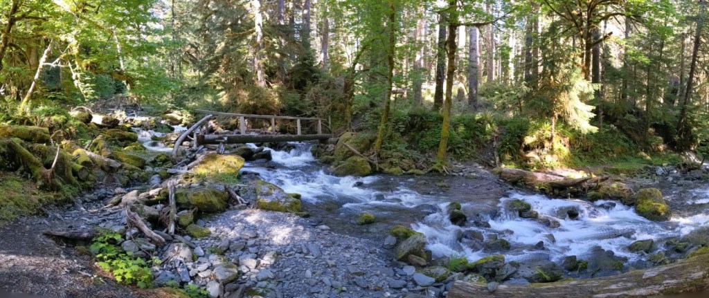
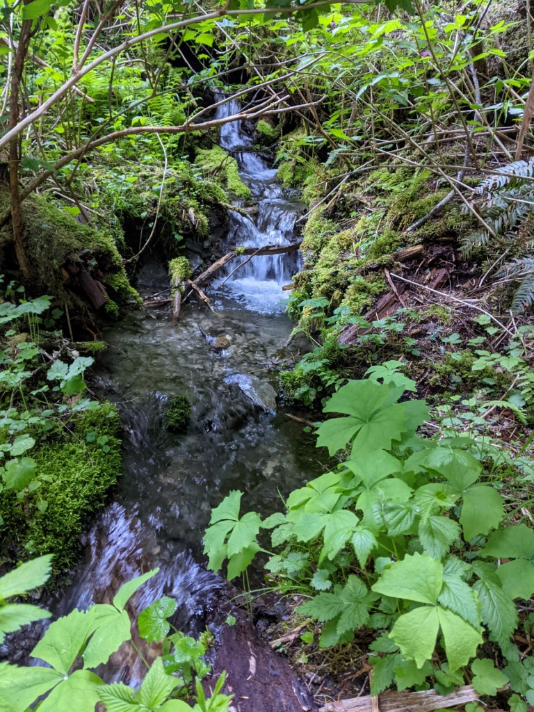
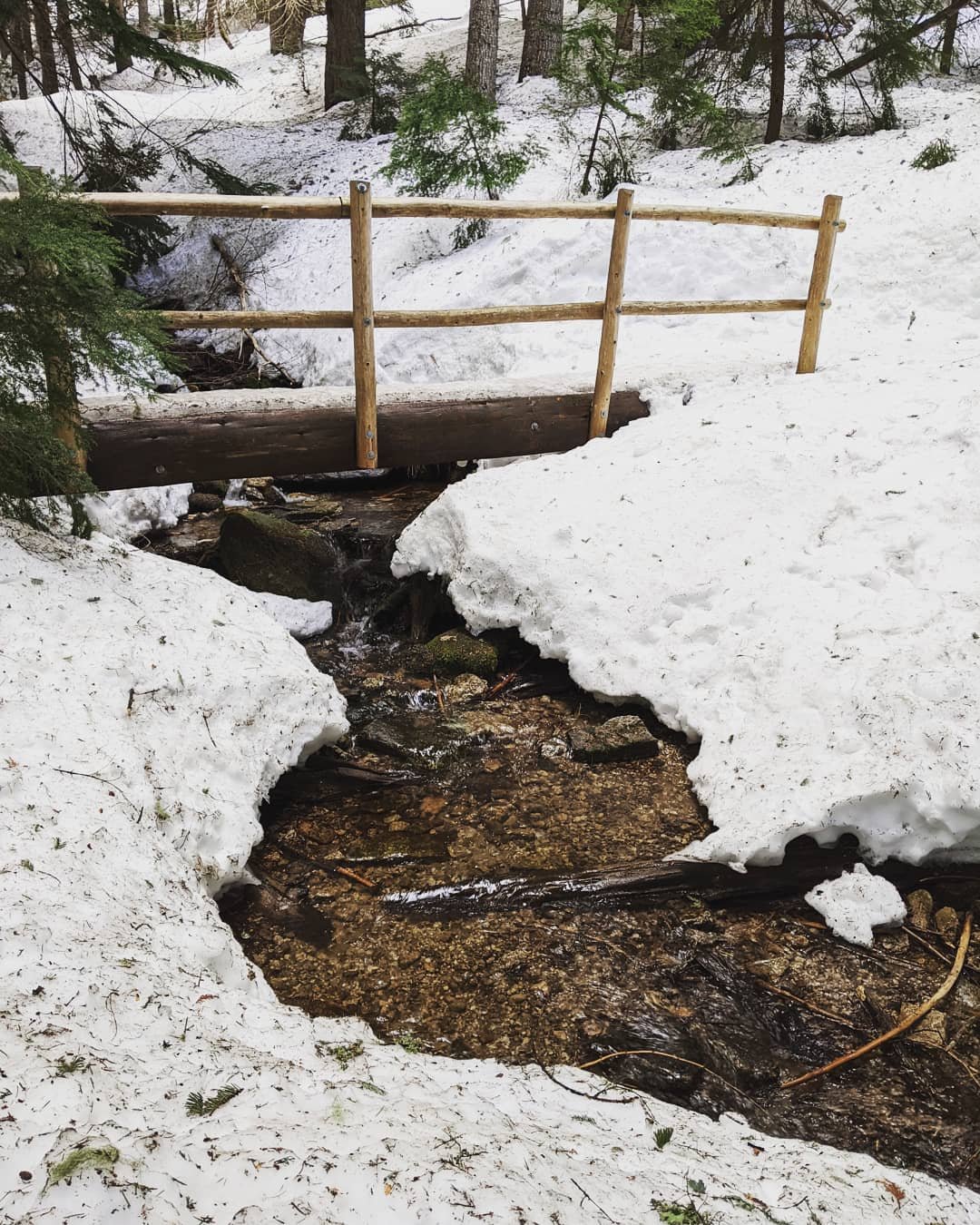
You will then cross over Burping Brooke on what looks to be a handmade wooden bridge.
I have hiked this trail many times and while the water was low this weekend, it can get high and extremely cold. It is a great spot to fill up on water.
Shortly after crossing Burping Brook, you will come to another ‘Y’ in the trail where Trail 110 goes in both directions. Follow the trail to the right and continue hiking towards the summit.
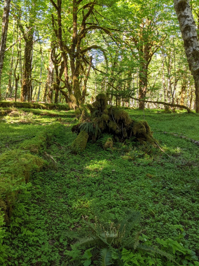
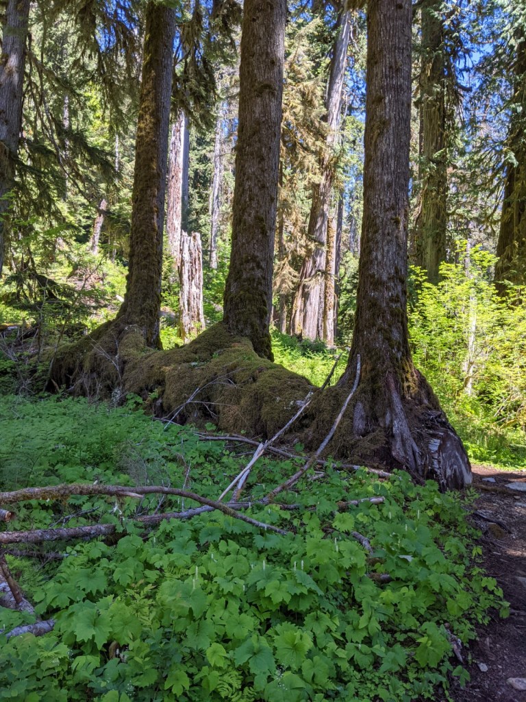
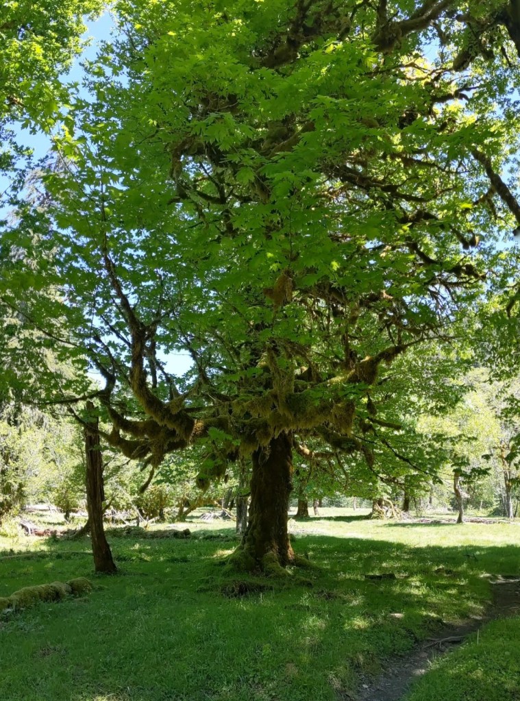
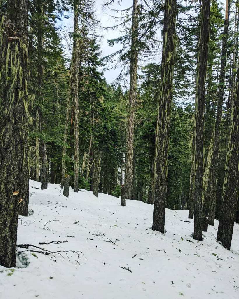
One of my favorite features of this trail is the natural overgrowth of moss. It comes out of the trees, stumps, bushes, and ground in multiple tufts and is a beautiful bright green, sometimes black. It also makes for great insulation if you are building a shelter.
You will hike for about 2 1/2 miles before finding yourself at Saddle Junction. This is a great area to stop and rest, and you will be met by a few trails; Trails 110, 140, 160, and Mount Kit Carson Loop Road.
Here is a quick breakdown of the trails that meet at Saddle Junction:
Trail 160 will lead you to the summit of Mount Kit Carson.
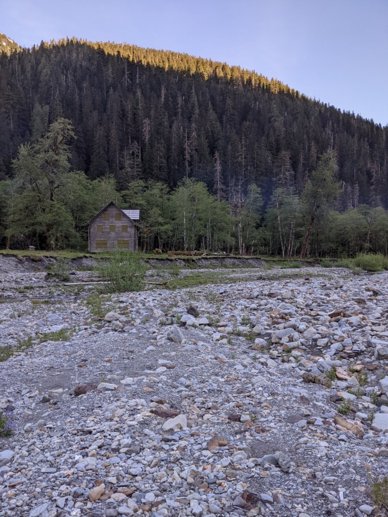
Trail 140 (heading in the northeast direction) will lead you to the CCC Cabin.
Trail 140 (heading southwest) will lead you back to the trailhead, meeting a few trails along the way.
Mount Kit Carson Loop Road (heading northwest) will lead you to the trail for Day Mountain as well as around the Mount Kit Carson.
Mount Kit Carson Loop Road (heading southeast) will lead you to the CCC Cabin as well as Beauty Mountain.
I do not recommend hiking along Mount Kit Carson Loop Road during the Winter season, as it is heavily trafficked with snowmobiles and downhill skiers. If you find yourself in trouble, however, it is a great area to be. The Rangers and other locals patrol this area and will stop for anyone in need of help. Paullena and I found ourselves in need of help this past winter and we were thankful for a local man who helped us on his snowmobile. He drove us to the CCC Cabin, then he and the Ranger got us down the mountain and safely to my car.
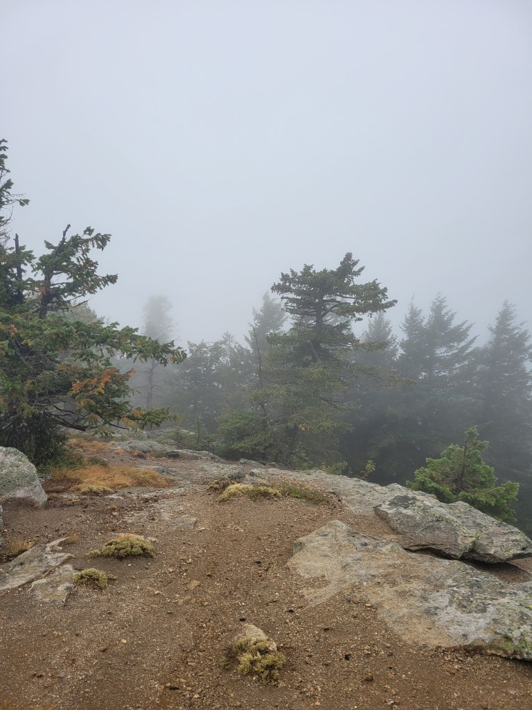
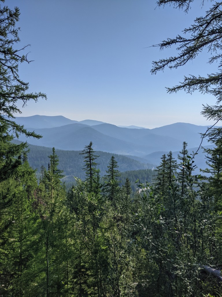
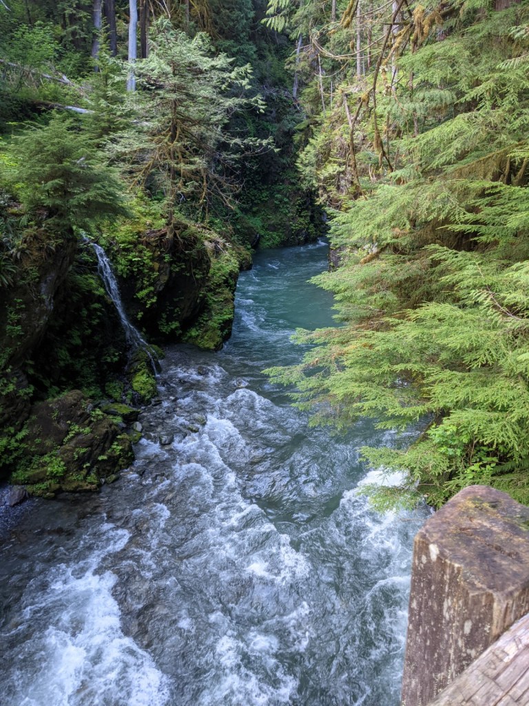
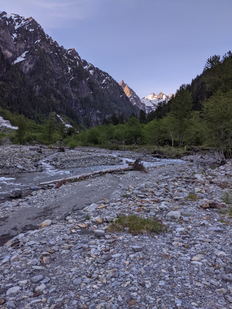
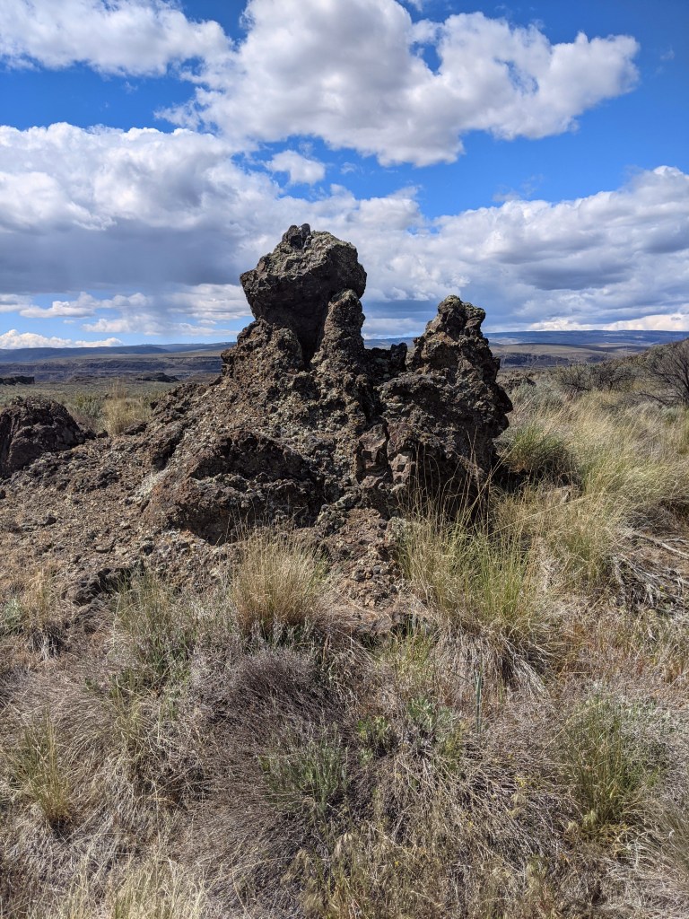
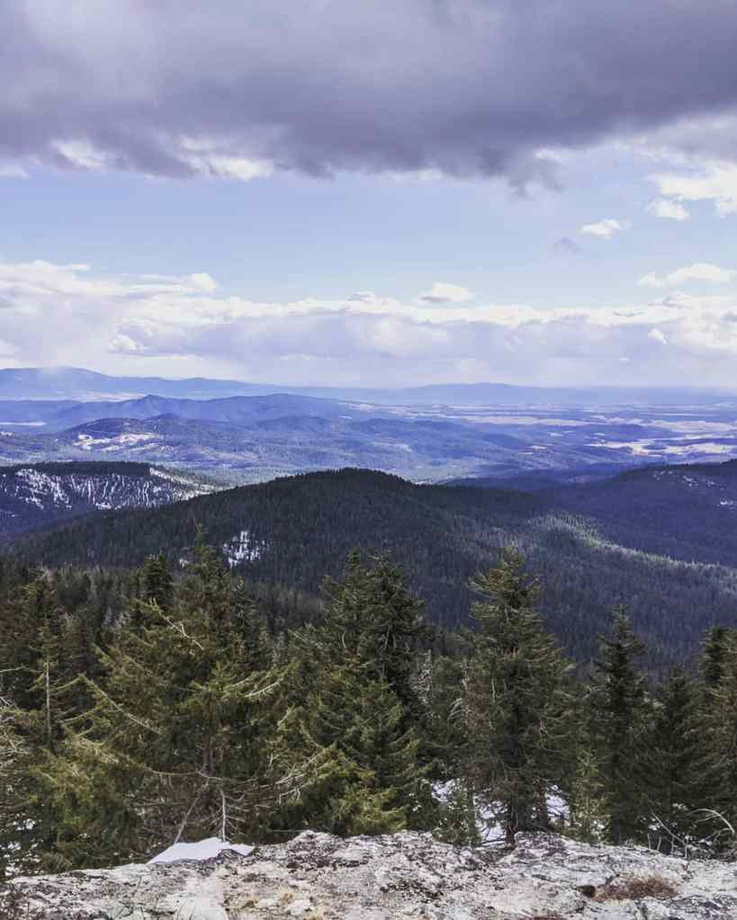
As you exit Trail 110 into Saddle Junction, you will see a sign for Mount Kit Carson. You will be on Trail 160 which will come to another ‘Y’ in the trail. Stay to the left and follow Trail 160 to the summit. The view at the summit is breathtaking. Absolutely breathtaking. One could easily just sit there all day, absorbing every detail of it.
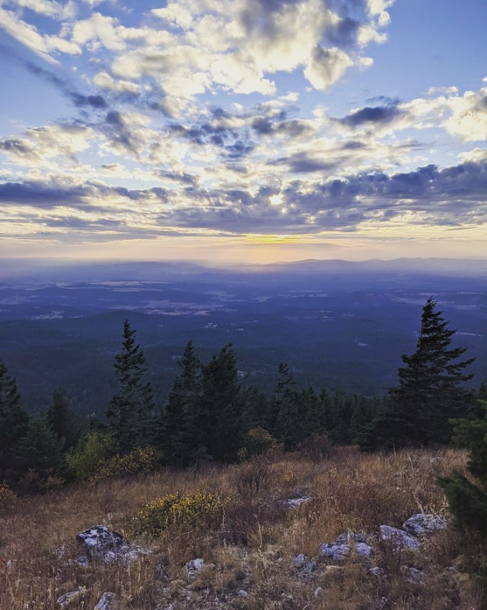
You may also go to the right onto Trail 130 which will take you to the lower part of Mount Kit Carson as well as Day Mountain. It is also a beautiful view so if you have the extra time, I would highly recommend hiking to the end of both trails.
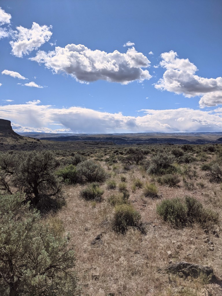
The view from the top of Trail 160:
We did not not hike to the top of Trail 130 for this trip, but here is the view from the top on a previous hike:
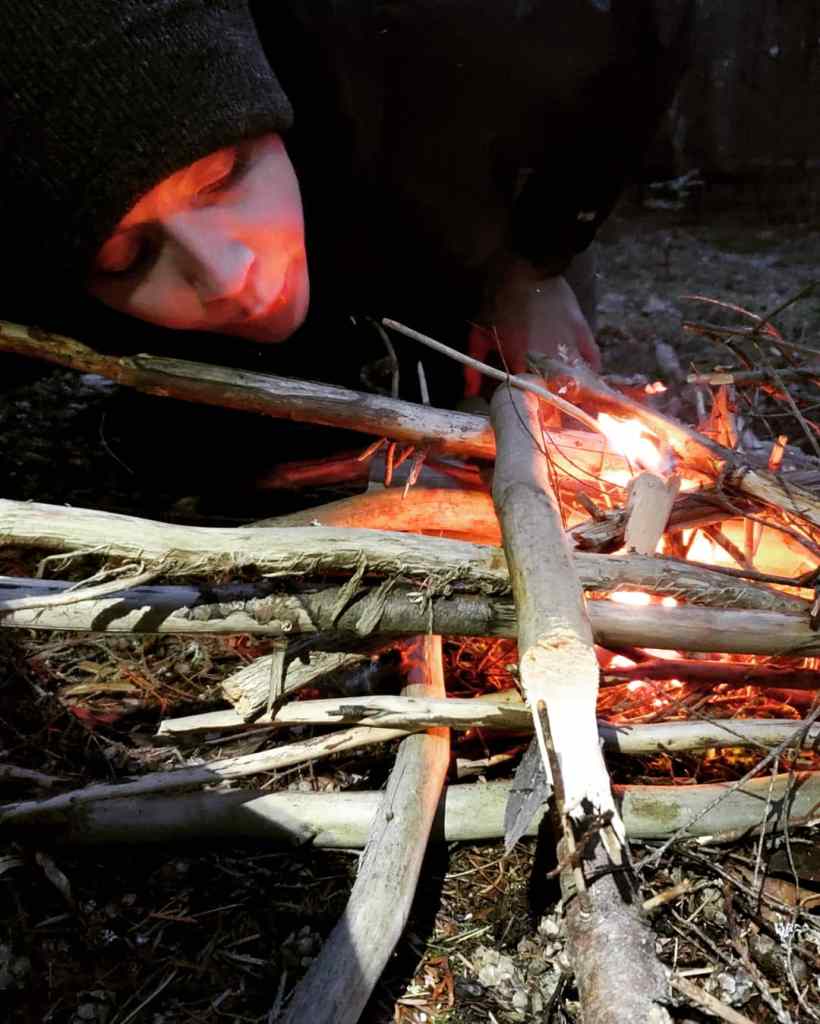
We made it back to our camp around 6:45 PM and were hungry, so we decided to start a fire for warmth and cook dinner. I use the Jetboil Flash which is a fantastic cook system. For dinner I decided on tortilla soup followed by s’mores trail mix made with honey Teddy Grahams, chocolate chips, and mini marshmallows. It was a rewarding treat for the end of the day.
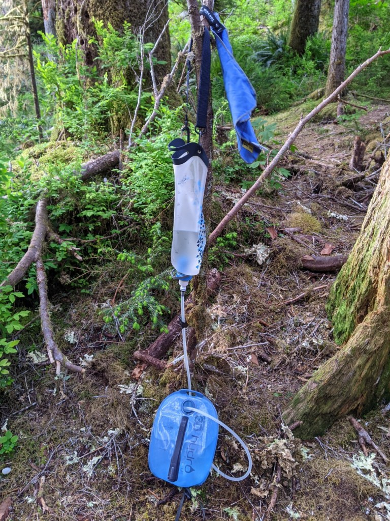
We were able to collect cold, fresh creek water throughout the evening and filtered it using my Katadyn BeFree water filtration system. One of the many great features of this water filtration system is that it allows me to drink directly from the nozzle or refill my water reservoir in a matter of minutes. When it came time to refill my water reservoir, I hung my Katadyn from a sturdy branch and started a fire while it refilled.
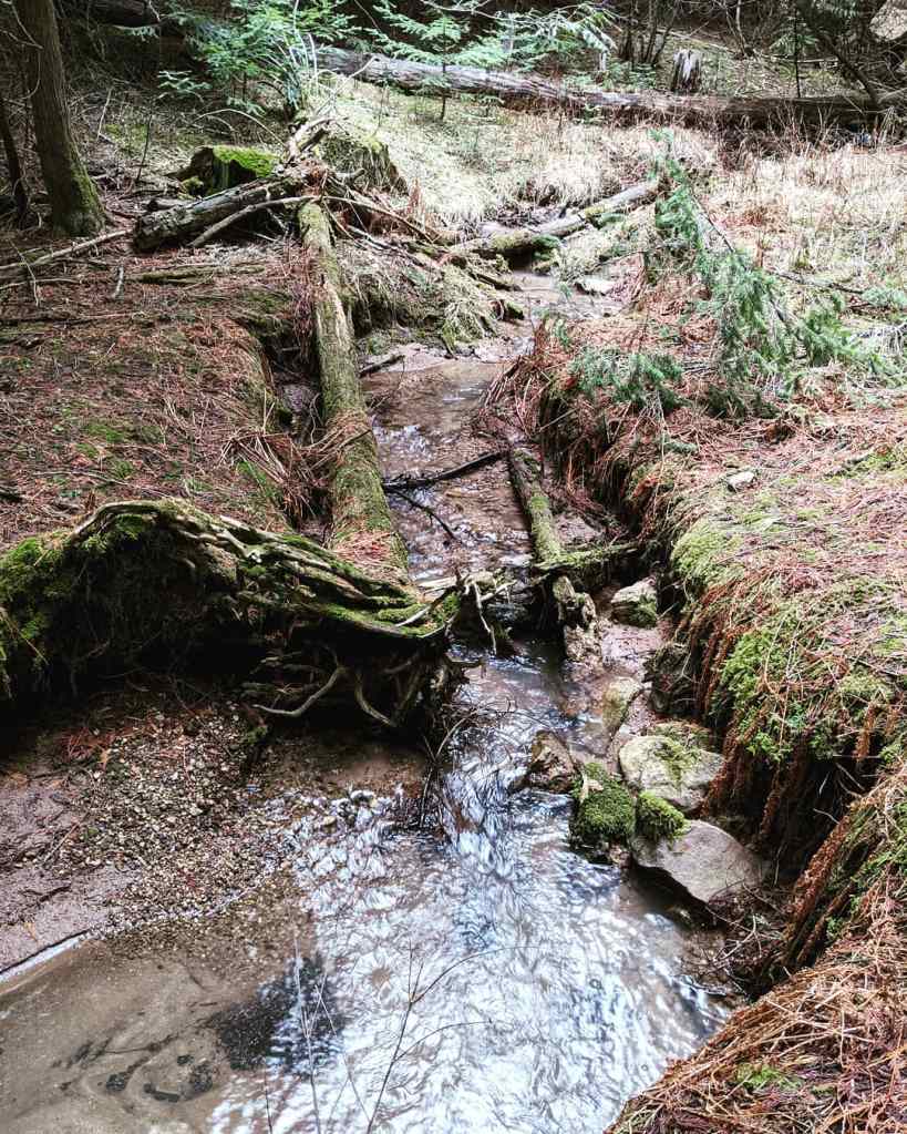
The creek near our camp.
We were awakened the next morning by the sound of turkeys on the other side of the creek which is a sound that will always make me laugh.
It was a pretty quick morning, as Paullena had to be home fairly early to care for her puppies. We started another fire and ate breakfast. I opted for a berry breakfast crumble (the recipe is from my membership with Backcountry Foodie), then packed up our camp and hiked towards the car.
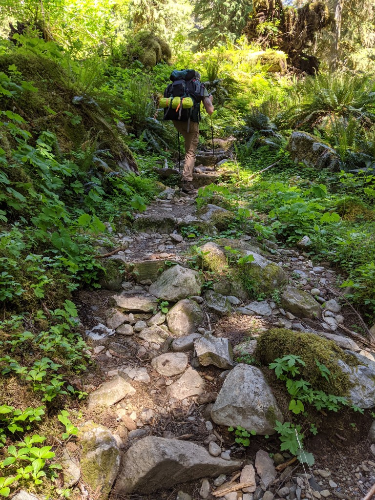
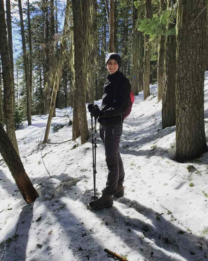
Let’s talk trekking poles. A few people have asked me about their importance.
• They reduce the impact on your legs, knees, ankles, and feet, especially when going downhill. •. They promote good blood circulation and help keep your hands, fingers, and wrists from swelling. • They incorporate your arms and shoulders, allowing you to propel yourself uphill and control your descent. • They help you maintain your balance. • They provide two additional points of contact, which improves your traction on surfaces such as mud, snow, and loose rock. •. They can be used in place of tent and hammock poles. • They help to alleviate some of the weight you carry by distributing it across four limbs instead of two. • You can use them to move brush, tree limbs, and other nuisances to the side.
Trekking poles can be very expensive, however, with a bit of research you can easily find a pair of good poles that are inexpensive.
• Aluminum is the more durable and economic option, though they weigh a bit more. They also hold up to being smashed around. •. Cork grips are moisture-resistant. • Most poles are adjustable. If not, head over to your local REI store and take advantage of their sizing chart.
When using your trekking poles, your arms should be at a 90° angle.
I ordered my trekking poles through Amazon, where I was able to find a good quality pair at a smaller price.
Brand name: TrailBuddy
They are made of strong, lightweight aluminum with quick adjust flip-locks, cork grips, and padded straps. They also came with interchangeable accessories; mud baskets, rubber tips, and snow baskets. These poles collapse down to 24.5 inches and extend up to 54 inches.
You can purchase trekking poles almost anywhere, however, the price and quality can be significantly different form company to company.